Last updated: May 11, 2026
- Type: Unincorporated community / Appalachian cove (valley enclosed on three sides by ridges)
- Location: Western escarpment of the Cumberland Plateau in Marion County, drained by the Little Sequatchie River, with a postal address at Sequatchie, TN 37374
- GNIS Feature ID: 1306108
- Coordinates: 35.1284° N, 85.5844° W
- Elevation: Approximately 620 ft at the valley floor
- USGS Quad: Whitwell
- Named for: The Coppinger family, early Irish-immigrant settlers of East Tennessee whose descendants moved into the cove in the 1800s
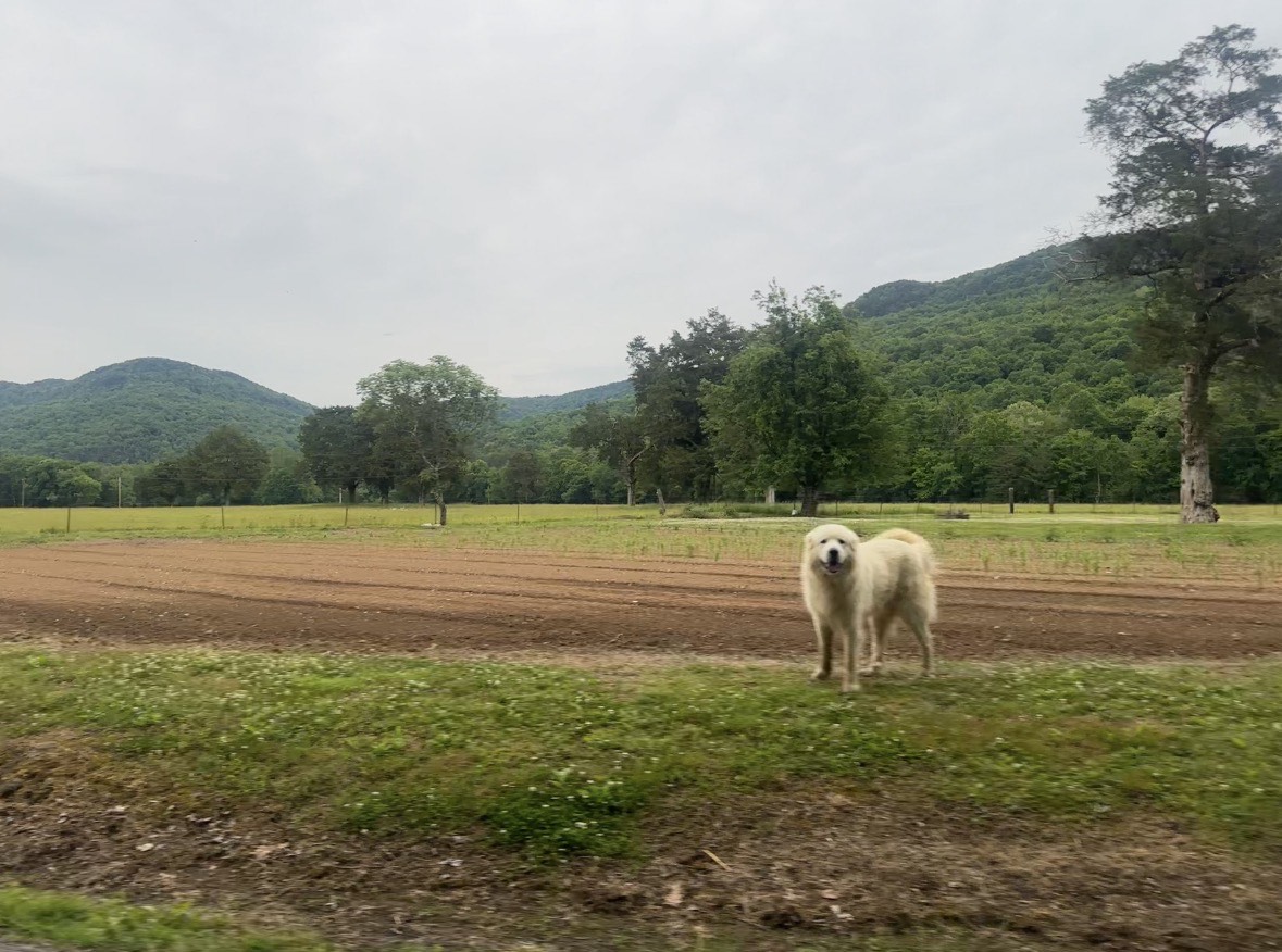
Coppinger Cove is a secluded hollow on the western escarpment of the Cumberland Plateau in Marion County. The Little Sequatchie River flows through the cove on its 19.6-mile journey from the plateau to the Sequatchie Valley floor, and the cove road follows the river through terrain of rocky cliffs, dense hardwood forest, caves, and small-scale farmland. The cove takes its name from the Coppinger family, who settled in the area in the early-to-mid 1800s and whose descendants figured in some of the most dramatic events in Marion County history.
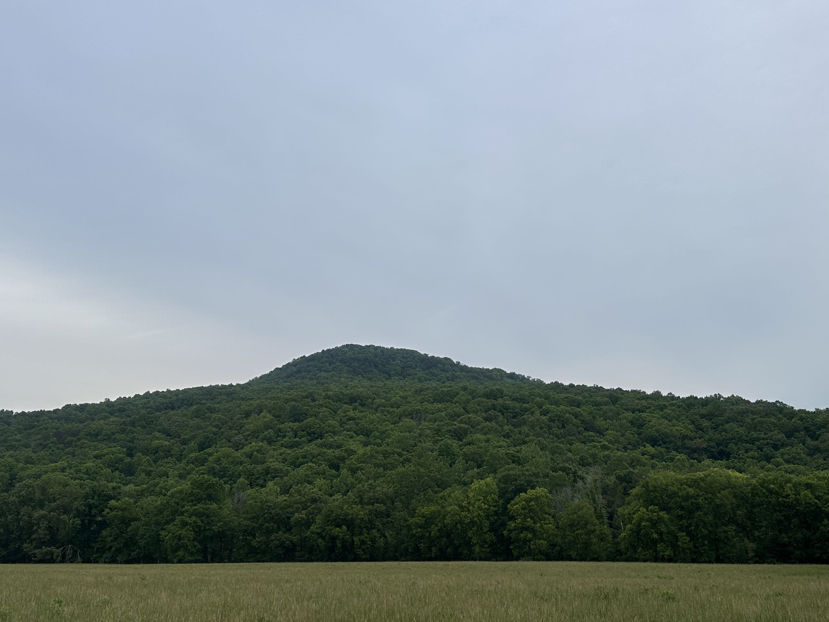
Setting
In Appalachian terminology, a "cove" is a valley enclosed on three sides by ridges, open on one end. Coppinger Cove fits this pattern: ridges of the Cumberland Plateau rise steeply on three sides, and the Little Sequatchie River drains out the open end toward the Sequatchie community on the valley floor. The cove is part of a network of interconnected hollows along the plateau escarpment, with neighboring coves including Dixon Cove, Bryant Cove, Indian Cove, Sequatchie Cove, and Petercave Cove. Access is from Valley View Highway (the road connecting Jasper and Whitwell) via Coppinger Cove Road, a paved county road that runs back into the cove past the Baptist church, the Sequatchie Cove Creamery, and the Keener family's Sequatchie Cove Farm before the pavement ends and the route continues as an unimproved trail up the plateau.
The geology is classic Cumberland Plateau karst: limestone dissolution has created caves, sinkholes, and underground streams beneath the sandstone caprock. Ship Cave, at the base of a large cliff in the cove, has two large openings where Ship Creek resurges after running underground. The cave system drew the attention of the Southeastern Regional Association of Cave Surveys (SERA), which held its 2017 Summer Cave Carnival in the area. Waterfalls, including Abraham Falls and Mike's Branch Falls, appear along tributary streams after heavy rain.
The place name comes from the Coppinger family, one of several Marion County coves that carry the name of a pioneer household. Neighboring Mullins Cove and the unincorporated Doran Cove follow the same pattern, with the Long, Doran, Inman, Mullins, and Coppinger surnames moving through the early 19th-century rolls of this stretch of the plateau together.
Cherokee and pre-Cherokee presence
Before Anglo-American settlement, the plateau escarpment above the Sequatchie Valley floor was part of the Cherokee homeland and, before that, of the much older Indigenous landscape of the Tennessee River country. Archaic (roughly 8000 to 1000 BC) and Woodland (roughly 1000 BC to AD 1000) peoples used the plateau's caves, rockshelters, and spring heads for hunting and seasonal camps; the karst features that still shelter the cove today, Ship Cave chief among them, are the same kinds of sites that earlier peoples used (see In the Beginning for the valley's prehistory). Coppinger Cove itself has not produced the kind of dense archaeological record that the river flats downstream at Nickajack and Running Water or the shell middens at Shellmound have, but the plateau-edge coves across Marion County generally carried light but continuous Indigenous use.
By the 18th century, the broader region was claimed and held by the Chickamauga (Lower) Cherokee who anchored their towns on the Tennessee River a short distance south. Nickajack and Running Water, destroyed in the 1794 Nickajack Expedition, sat within a day's travel of the Little Sequatchie headwaters. Under the Treaty of 1819, Cherokee reservees held 640-acre tracts along Battle Creek and near present-day Jasper; that window of coexistence closed by the mid-1820s through local violence and, for those who remained, with the 1838 Trail of Tears. The Cherokee Nation, today a sovereign nation headquartered in Tahlequah, Oklahoma, traces a portion of its ancestry through the families who held this stretch of the plateau. For the fuller regional picture, see The Cherokee Lower Towns, Dragging Canoe, and the 1794 Nickajack Expedition.
The Coppinger family
The cove's namesake family traces to Higgins Coppinger (1738, Ballyvolane Castle, County Cork, Ireland, to January 4, 1832, Washington County, Tennessee), a Revolutionary War veteran who settled in upper East Tennessee. His descendants moved south and west through the state's valleys over the following generations. Walter Coppinger (born c. 1790, Tellico Plains, Monroe County) married Rachel Tussey, and their son Alexander Coppinger (1821 to 1863) lived in the Sequatchie area of Marion County. Alexander married Susan Allison and is buried in Lasater Cemetery. He died on May 31, 1863, in the middle of the Civil War; the circumstances of his death do not appear in surviving records, and whether it was combat, guerrilla violence, or disease is unknown.
The Coppinger family appears in James L. Douthat's Sequatchie Families: Biographical Sketches of the Earlier Settlers of the Sequatchie Valley of Tennessee (1983), one of the standard genealogical references for the region. The surname appears alongside Long, Mullins, Doran, and Inman in the cove-edge rolls of the early 19th century, and the first-settler chronology for Marion County's plateau-edge coves is laid out on the First Settlers page.
The neighboring plateau coves intermarried freely in the mid-19th century, and the family threads run from one cove to the next. Sarah Ann Coppinger married Dallas Dixon (January 1, 1846 to March 1923) on May 24, 1868; Dallas was born and died in Dixon Cove, the neighboring hollow to Coppinger Cove, and is buried at Lasater Cemetery. He and his twin brother Polk both served as privates in Company G of the 6th Regiment Tennessee Mounted Infantry, a Union unit that mustered in on October 24, 1864 and mustered out on September 6, 1865; theirs is one of the few documented enlistments tying the cove families to federal service during the Civil War. The Coppinger–Dixon line produced seven children between 1869 and 1891. The intermarriage helps explain why the modern Sequatchie Cove Farm sits at the seam where Dixon Cove Road and Coppinger Cove Road meet, on land the Wright and Keener families now work: the two coves have been kin country for more than a century and a half.
Sheriff Coppinger and the 1927 Christmas shootout
The most well-known Coppinger from Marion County is Sheriff George Washington "Wash" Coppinger, who was killed on Christmas night, December 25, 1927, in South Pittsburg. The incident grew out of a labor dispute at the H. Wetter Manufacturing Company stove factory. When the company tried to reopen with non-union labor, tensions between the county sheriff's office and South Pittsburg city police escalated. Sheriff Coppinger, along with deputies, responded to a confrontation where city officers had held a county deputy at gunpoint. When the sheriff attempted to make an arrest, gunfire erupted. Six law enforcement officers died: Sheriff Coppinger, Deputy Langford A. Hennessey, City Marshals Benjamin Parker and Ewing Smith, Wetter guard Oran H. LaRowe, and Police Chief James Connor (who died the following day).
Sheriff Coppinger and his wife Sarah E. are buried in Bean-Roulston Cemetery. A Tennessee Historical Commission marker (2B-32, HMdb #99022) was dedicated July 20, 2014 at the intersection of Cedar Avenue and Third Street in South Pittsburg, the location of the gun battle. The shootout is one of the deadliest single incidents in Tennessee law-enforcement history. See the dedicated 1927 Christmas Night Shootout page for the full account, including the verbatim Tennessee Historical Commission marker text and the contemporary South Pittsburg Hustler coverage from January 5, 1928.
Church, school, and cemetery
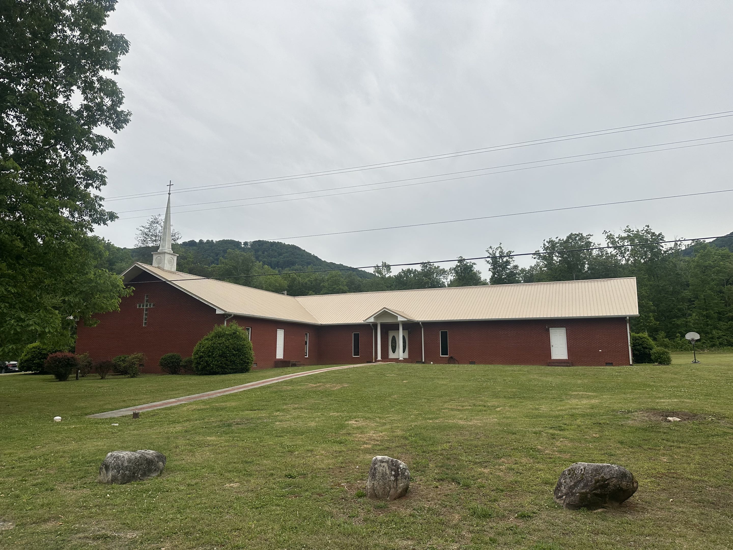
Coppinger Cove Baptist Church (Southern Baptist Convention) stands at 1365 Coppinger Cove Road, Sequatchie, TN 37374, and remains an active congregation. The USGS stream gage on the Little Sequatchie River is identified as "Little Sequatchie River NR Coppinger Chapel, TN" (Station 03571485), indicating that an earlier Coppinger Chapel was a recognized landmark, though whether it was a predecessor of the current Baptist church or a separate structure is unclear.
Coppinger's Cove School is listed among the historic schools of Marion County on the TNGenWeb site (see historical schools roster); its operating dates do not appear in the surviving school records. Coppinger Cemetery, a small family burial ground in the cove, is listed in the Marion County cemetery rolls.
Camp Glancy
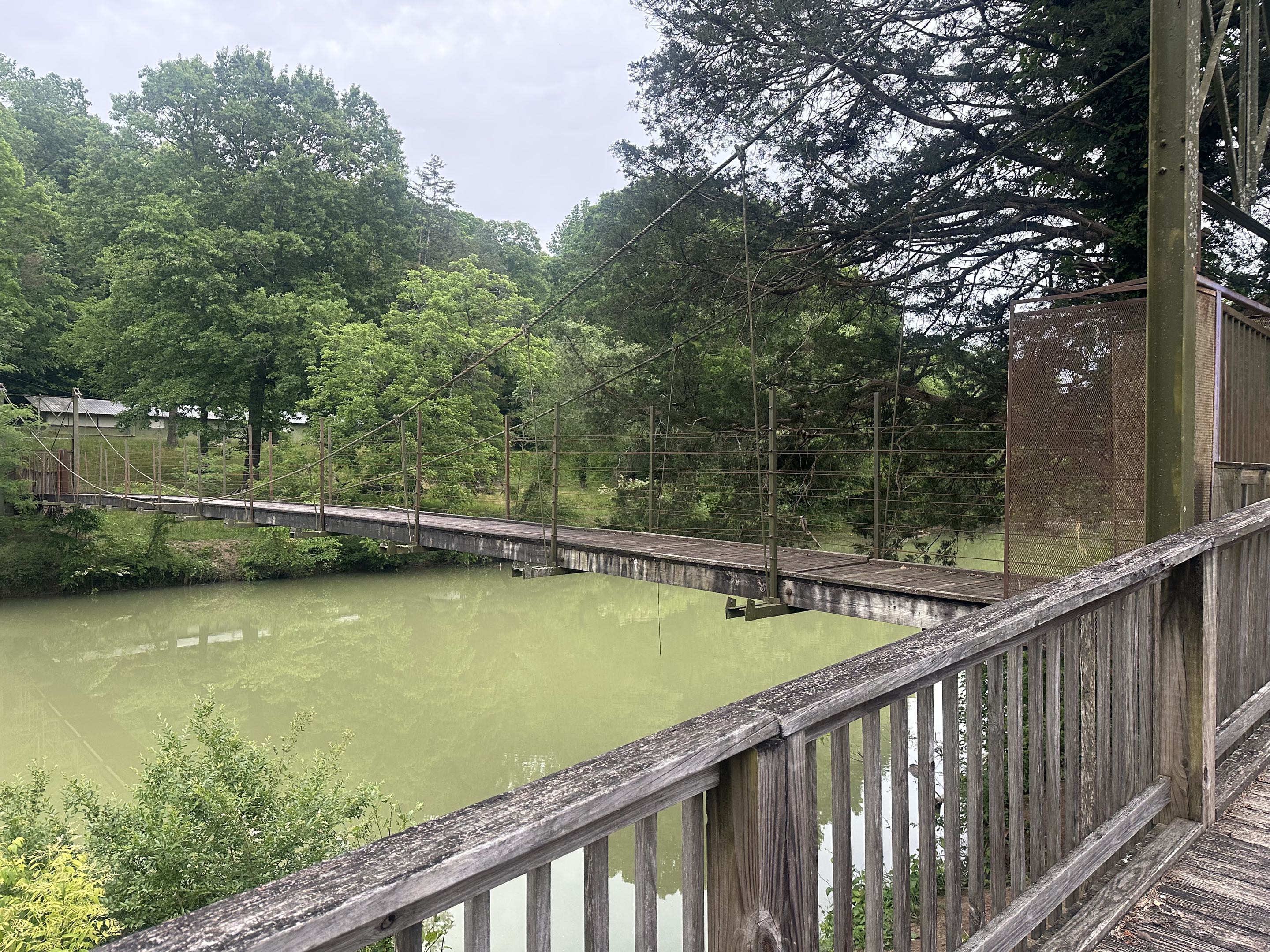
Camp Glancy (GNIS Feature ID 1279388) sits on 27 acres along the Little Sequatchie River between Jasper and Whitwell, at the mouth of Coppinger Cove where it opens onto the valley floor near the Sequatchie community. The camp takes its name from Glancy Sherman (1862 to 1935), a Pennsylvania-born industrialist and philanthropist who settled in Sequatchie in 1889 and became the community's most prominent figure. Mr. and Mrs. Sherman deeded the 27-acre tract to the Chattanooga area Girl Scout Council in 1928, and the council opened the property as a summer camp the following year.
The camp operated as a Girl Scout camp from 1929 through 1942, when the need for improvements and the inability to acquire adjoining land led the council to relocate. Nearly a decade later, in the summer of 1951, the dam at the Chattanooga Boy Scouts' Camp Tsatanugi failed and the council judged that property too small for its needs without it; the Chattanooga Area Council leased Camp Glancy for three weeks that summer instead. Two CAC field executives ran the temporary camp: Vick Vickery as program director and George Coward as business manager. Meals were served on long wooden tables in the dining hall, and the swinging bridge over the Little Sequatchie River was the only way to bring supplies in. The camp's swinging bridge, then and now, is its most memorable feature, visible in the photo above.
After the Girl Scouts left the property in 1942, Bertha Sherman deeded the tract to the Chattanooga Presbytery of the Cumberland Presbyterian Church, which has run it since as a Christian camp and retreat center. The swinging bridge and the river bend that defined the Girl Scout years still anchor the property, which is available to church, civic, and family groups. For more on Glancy Sherman and the mansion he built in the Sequatchie community, see the Sequatchie community page.
Sequatchie Cove Farm and Creamery
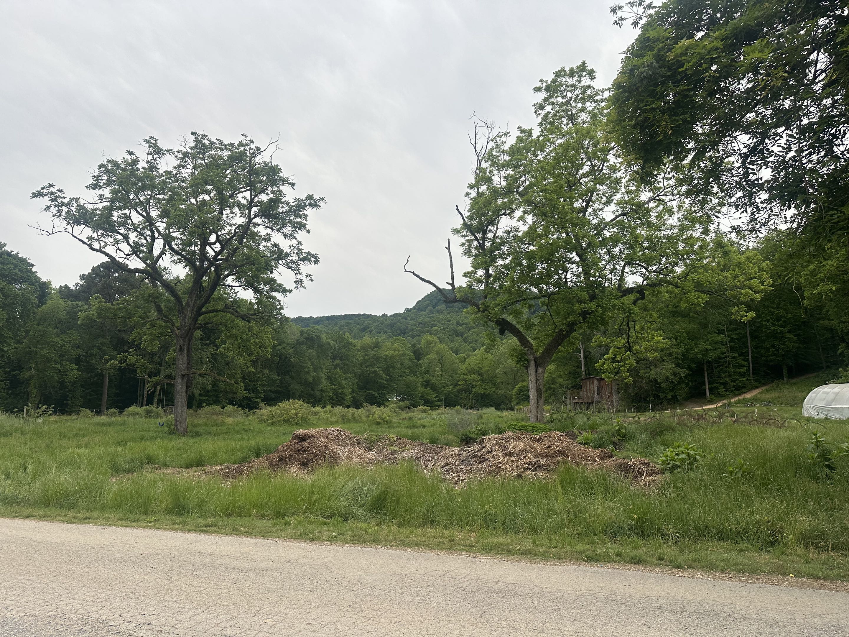
In recent decades, Coppinger Cove has drawn attention for artisan agriculture. Sequatchie Cove Farm, a 300-acre diversified operation sits on Dixon Cove Road along the Little Sequatchie River, where Dixon Cove and Coppinger Cove overlap. The farm is now in its fourth generation: Jim and Emily Wright purchased the land along the river, their daughter Miriam and her husband Bill Keener built the diversified operation that defines the farm today, their son Kelsey Keener and his wife Ashley work the next generation of the rotation, and the Keener grandchildren Fletcher, Oliver, and Ella Mae are the fourth. The farm produces grass-fed beef, heritage pork, pasture-raised chicken and Katahdin lamb, pasture-raised eggs, organic produce, grains, and small fruits (raspberries, blackberries, muscadines, blueberries), using rotational grazing and biodynamic practices. Sales channels include the on-farm Trading Post (Saturdays 9 a.m. to noon, year round), the Main Street Farmers Market in Chattanooga, and a partnership with the Cumberland Folk School, which offers hands-on classes in sustainable farming and traditional crafts on the property.
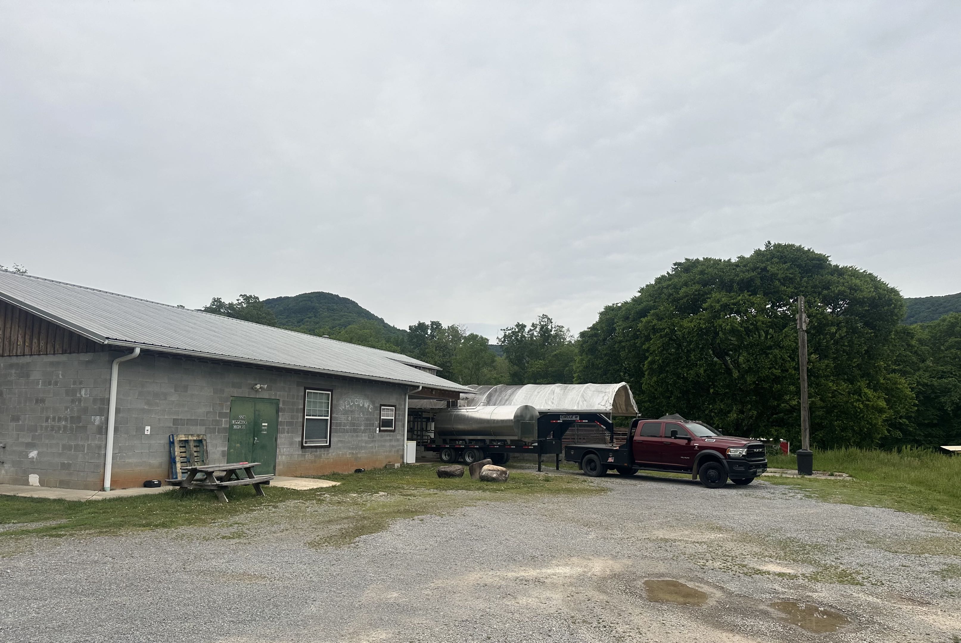
The Sequatchie Cove Creamery, the farm's cheese operation, is located at 2216 Coppinger Cove Road, placing it squarely within the cove. Founders Nathan and Padgett Arnold trace the creamery's design to a 2004 trip to the Terra Madre Slow Food gathering in Italy, where they were drawn to traditional French Alpine cheeses; Nathan then traveled to France, Vermont, Canada, and Wisconsin between 2005 and 2006 to study cheesemaking before the creamery was licensed in March 2010. The signature cheese, "Coppinger," is a semi-soft washed-rind in the tradition of ash-lined French styles like Morbier, with a decorative line of vegetable ash through its center that the creamery says "reminds us of the Little Sequatchie River running through the valley." The creamery's other cheeses are Cumberland, a natural-rind tomme that won first place in its category at the American Cheese Society conference in 2012; Shakerag Blue, wrapped in fig leaves soaked in Chattanooga Whiskey; and Walden, a quick-pasteurized 30-day cheese launched in 2019. The creamery ran its own herd of grass-fed Jerseys for its first decade of operation and sold the herd in 2021, switching to sourcing what it calls "the best grass milk we've found in this region" from neighboring dairies.
Off-road recreation
Coppinger Cove Road is paved through the inhabited part of the cove past the Baptist church, the creamery, and the Keener family's farm. Beyond the farm the pavement ends and the route continues as an unimproved trail that climbs the Little Sequatchie corridor and crosses the river repeatedly. After heavy rain the trail carries deep water crossings, rock gardens, and mud, and it has become a regionally known off-road destination on that stretch. From the top, the trail connects to the Coalmont OHV Park (1,347 acres) atop the plateau and links with routes through Bryant Cove, Indian Cove, Sequatchie Cove, and Petercave Cove in a broader loop system. River fords, cave entrances, and seasonal waterfalls mark the unpaved upper section.
Present day
Coppinger Cove remains a lightly populated hollow with scattered homes, farms, and the Baptist church along Coppinger Cove Road. The postal address is Sequatchie, TN 37374. The combination of artisan agriculture, cave exploration, and off-road recreation has brought the cove more outside attention in recent years than at any time since the Coppinger family first cleared its bottomland in the 1800s.
Landmarks and features
- Little Sequatchie River, flowing through the cove
- Ship Cave (large dual-entrance cave at the base of a cliff)
- Coppinger Cove Baptist Church (1365 Coppinger Cove Road)
- Coppinger Cemetery
- Sequatchie Cove Farm and Creamery (Dixon Cove Road / Coppinger Cove Road)
- Abraham Falls and Mike's Branch Falls (seasonal waterfalls)
- Camp Glancy (retreat center on the Little Sequatchie River, GNIS 1279388)
- Coppinger Cove Road off-road trail system
Related
Sequatchie community →
Mullins Cove →
Victoria →
The Sequatchie Valley →
First settlers of Marion County →
The 1927 Christmas Night Shootout →
The Marion County Sheriff →
Sources
- Coppinger Cove (GNIS ID 1306108) — HometownLocator
- Wikipedia — Little Sequatchie River
- USGS — Little Sequatchie River NR Coppinger Chapel, TN (Station 03571485)
- WikiTree — Higgins Coppinger (1738-1832)
- Find a Grave — Alexander Coppinger (1821-1863)
- WikiTree — Dallas Dixon (1846-1923), Lasater Cemetery
- Officer Down Memorial Page — Sheriff G.W. Coppinger
- HMdb — Christmas Night Shootout historical marker
- Sequatchie Cove Creamery — Coppinger cheese
- The Cheese Professor — Sequatchie Cove Creamery (cheese roster, 2012 ACS award, 2021 herd sale)
- Sequatchie Cove Farm
- Sequatchie Cove Farm — About / four generations of the Wright and Keener families
- Chattanooga BSA History — Camp Glancy (1928 deed, 1929-42 Girl Scout era, 1951 Boy Scout summer)
- Coppinger Cove Baptist Church — FaithStreet
- Marion County Old Schools — TNGenWeb
- Coppinger Cove — Rootsweb TNGenWeb Marion County
- Chattanoogan — The Difference One Man Can Make: Remembering (And Reviving) The Spirit Of Glancy Sherman (October 3, 2023)
- Chattanoogan — John Anthony Smith To Throw Open Doors at 1st Annual Glancy Harvest Festival (September 7, 2023)
- Camp Glancy (GNIS 1279388) — AnyPlace America
- Community contribution via the Glancy Manor, LLC Facebook page (2026), citing A History of South Pittsburg, TN: The First 100 Years for Bertha Sherman's deed of Camp Glancy to the Chattanooga Presbytery of the Cumberland Presbyterian Church