Last updated: June 1, 2026
Marion County's history reaches back thousands of years before the first written record and then moves through a series of narrative chapters on this page. Each has at least one dedicated subpage for deeper treatment: the deep prehistory of the valley's first peoples and the excavation at Russell Cave, the Spanish explorers and the Native American trail network, the Cherokee Lower Towns and the Chickamauga Wars, the 1817 county formation and the first settlers, the 1838 Trail of Tears, the antebellum valley and the Civil War engagements at Sweeden's Cove and along the Cracker Line, Reconstruction, the industrial boom, the New Deal, the world wars, TVA, and the modern era. Use the contents list below to jump to a chapter, or skip to the subpages near the bottom of the page for the full list of dedicated topic pages.
In the Beginning: The First Peoples
Before recorded history
Human life in the Sequatchie country reaches back the better part of ten thousand years. The salvage excavations carried out before Nickajack Dam flooded the river found that people had occupied this stretch of the Tennessee as early as 6,000 to 7,000 B.C., and a hearth at Russell Cave, just over the Alabama line below South Pittsburg, was radiocarbon-dated to roughly 9,000 years ago. Archaeologists read that long span as a "cultural continuum" running through three broad stages: the Archaic hunters who threw stone-tipped spears with the atlatl, the Woodland people who made pottery, grew corn, and raised the earthen burial mounds that still dot the valley, and the Mississippian villagers and temple-mound builders whom the first Europeans would eventually meet.
Much of what is known comes from a single remarkable site. In 1956 a crew of South Pittsburg coal miners, hired by the Smithsonian and led in the field by Carl F. Miller, excavated Russell Cave layer by layer and uncovered one of the longest continuous records of human occupation of any cave in the eastern United States. The work proved that Native Americans had roamed the Sequatchie country, as Raulston and Livingood put it, "long before the pyramids of Egypt were built." Earlier surveys by Clarence B. Moore (1914–1915) and William Edward Myer (1918) had already traced mounds and villages along the Sequatchie and Tennessee rivers, at Long Island, Shellmound, and the Bennett farm.
Read more about the valley's first peoples →
Russell Cave: the 1956 excavation and the 9,000-year record →
The Early Explorers & the Trail Network
1540–1567
More than two centuries before permanent settlement, three Spanish expeditions reached the Tennessee River country around what is now Marion County, the first Europeans known to enter the region. In June 1540 Hernando de Soto and some seven hundred men rested for about a month at Chiaha, a fortified Native American town on an island in the river. In 1560 a detachment from Tristan de Luna's expedition visited the chiefdom of the Napochies in the same river valley, and in 1567 the men of Juan Pardo returned to Chiaha and built a short-lived fort there. None of the expeditions stayed, and historians still argue over exactly where Chiaha stood; the oldest reconstruction, and a marker at Kimball, place it at Burns' Island just below the mouth of the Sequatchie.
The Spaniards traveled the river, but the country they crossed was already laced with overland Native American trails, the Black Fox, Sequatchie, Nickajack, Chickamauga, and Great Indian Warpath routes, which converged at the Old Creek Crossing, a ford in the Tennessee at the south end of Long Island near present-day South Pittsburg. The crossing made the lower Sequatchie country a meeting point for many nations long before any of them were set down in writing.
Read more about the early explorers →
Chiaha: the lost town De Soto found →
The Native American trails and the Old Creek Crossing →
Cherokee Homeland & the Chickamauga Wars
Before 1794
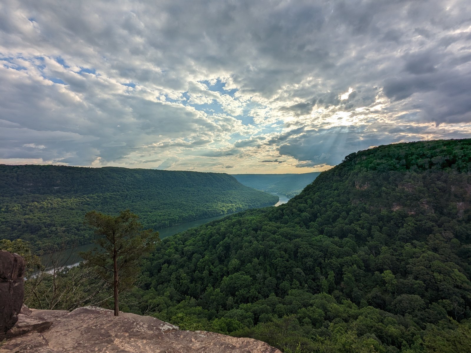
Long before European settlers crossed the Cumberland Plateau, the lands that would become Marion County belonged to the Cherokee. The Tennessee River Gorge, the Sequatchie Valley, and the caves along the river bluffs were part of a territory the Cherokee had occupied for centuries. The valley's fertile bottomland, abundant game, and navigable waterways made it a natural corridor for trade and settlement.
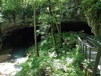
The region's significance deepened in the late 1770s when Dragging Canoe, a Cherokee war leader who rejected the treaties ceding Cherokee land to American settlers, relocated his followers westward from the Overhill towns. Around 1779 he established the Chickamauga Lower Towns, a constellation of settlements including Nickajack and Running Water, at the mouth of Nickajack Cave and along the Tennessee River in what is now southern Marion County. These towns became the center of Chickamauga resistance against American expansion, launching raids on frontier settlements across Tennessee and Kentucky for nearly two decades.
The Cherokee scholar Sequoyah, who would later create the Cherokee syllabary and revolutionize literacy among the Cherokee people, was born around 1776 at Tuskegee in the Overhill country and later settled at Willstown in northern Alabama, where the surviving Lower Towns communities regrouped after 1794. His association with the post-Lower-Towns Cherokee world is a reminder that these communities were not merely military outposts but living societies with deep intellectual and cultural traditions.
The Chickamauga Wars ended abruptly on September 13, 1794, when a Southwest Territory militia under Major James Ore, guided by Joseph Brown, a former captive of the Cherokee, crossed Monteagle Mountain and destroyed Nickajack and Running Water in a dawn raid. About 70 Cherokee were killed; only three Americans were wounded. The raid broke Chickamauga resistance and led directly to the Treaty of Tellico Blockhouse in November 1794, which opened the area to American settlement.
Read more about the Cherokee Lower Towns →
The Chickamauga Wars, 1776–1794 →
The Nickajack Expedition, September 1794 →
County Formation & Early European Settlement
1794–1820
European-American pioneers began arriving in the Sequatchie Valley around 1805, with Amos Griffith and brothers William and James Standifer among the earliest. The area was then part of Roane County; the upper valley had been split off as Bledsoe County in 1807, but the southern reaches, the gorge, the river crossings, the plateau escarpments, remained administratively distant from any courthouse.
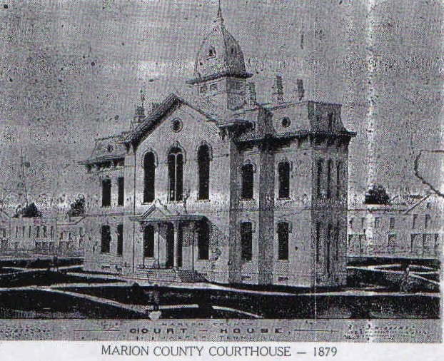
The Treaty at the Cherokee Agency (July 8, 1817) ceded the lower Sequatchie Valley to the United States, and on November 20, 1817, the Tennessee General Assembly created Marion County from the ceded land. It was named for Brigadier General Francis Marion, the legendary "Swamp Fox" of the Revolutionary War. The first court convened that same year in the house of John Shropshire, in what is now Whitwell. Two years later, the county seat moved to Jasper, on forty acres purchased from Betsy Pack, a Cherokee woman. The first courthouse was built on the tract where the present one still stands. Cherokee reservees and settler families held land in the county side by side for nearly two decades, until a mix of local violence and the 1838 Trail of Tears closed the window.
Read more about the 1817 county formation: the treaty, the act, the first court, and the courthouses →
The first settlers, their family lines, and the Cherokee coexistence that ran alongside them →
The Antebellum Valley
1820–1860
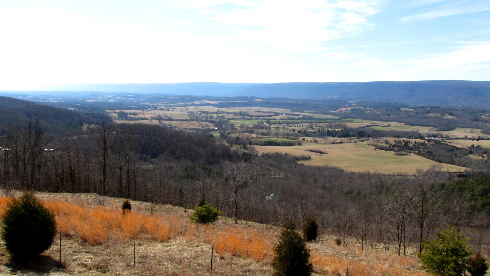
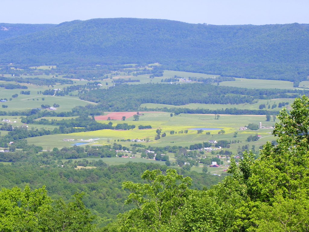
Antebellum Marion County was a world of small family farms spread along the Sequatchie Valley floor, with subsistence homesteads scratched into the thin soil of the plateau edges. The valley's geography, narrow, hemmed in by ridges, meant that large-scale plantation agriculture never took hold the way it did in Middle and West Tennessee. Enslaved people were present in the county, but in far smaller numbers than in the cotton belt; the economy ran on free labor, livestock, and corn.
Transportation was limited and difficult. The Tennessee River formed the county's southern boundary and served as a commercial highway, but the stretch through the gorge was treacherous. Rapids with names like The Suck, The Boiling Pot, The Skillet, and The Frying Pan wrecked flatboats and terrified rivermen. Overland roads were rough and seasonal. The county remained isolated by the standards of the era.
The Trail of Tears in 1838 and 1839 forced the remaining Cherokee westward, severing a connection to the land that stretched back centuries. The Bell detachment camped at the head of Battle Creek at Martin Springs in late October 1838 and climbed the Monteagle grade on its way north toward Winchester and west on the Nashville Turnpike, using the same plateau crossing that Joseph Brown and Major James Ore had descended in 1794. Jasper continued to grow as the civic center. Churches, schools, and courts were established. Families who arrived in the 1810s and 1820s, names like Standifer, Shropshire, and Turney, put down roots that would persist for generations. But by the late 1850s, the nation was fracturing, and Marion County sat directly in the path of what was coming.
Read more about the Trail of Tears through Marion County →
Civil War
1861–1865
Like much of East Tennessee, Marion County was deeply divided by the war. The county lacked the plantation economy that bound West Tennessee to the Confederacy, and many Sequatchie Valley families held strong Unionist sympathies. But Confederate support was real too, the county sent sons to both armies, and the division cut through families and neighborhoods.
Marion's geography made it a crossroads. The county sat on the main corridor between Nashville and Chattanooga, and the Tennessee River crossings were strategically critical. Armies from both sides moved through the valley, requisitioning food and livestock, pressing civilians into service, and leaving destruction in their wake.
The first significant engagement in the county came on June 4, 1862, at Sweeden's Cove (also spelled Sweeten's Cove), about seven miles north of South Pittsburg. Brigadier General James S. Negley's Union brigade, including elements of the 79th Pennsylvania Infantry and the 5th Kentucky Cavalry, engaged roughly 600 to 800 Confederate cavalrymen under Colonel John Adams, who had crossed the Tennessee from Chattanooga under orders from General P.G.T. Beauregard. It was a sharp, decisive Union victory: two Federal soldiers killed and seven wounded, against about 20 Confederate dead buried at the Bean-Roulston Cemetery. For the 79th Pennsylvania, it was their first engagement of the war.
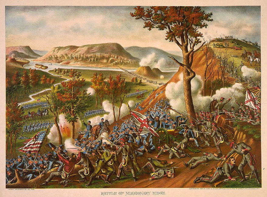
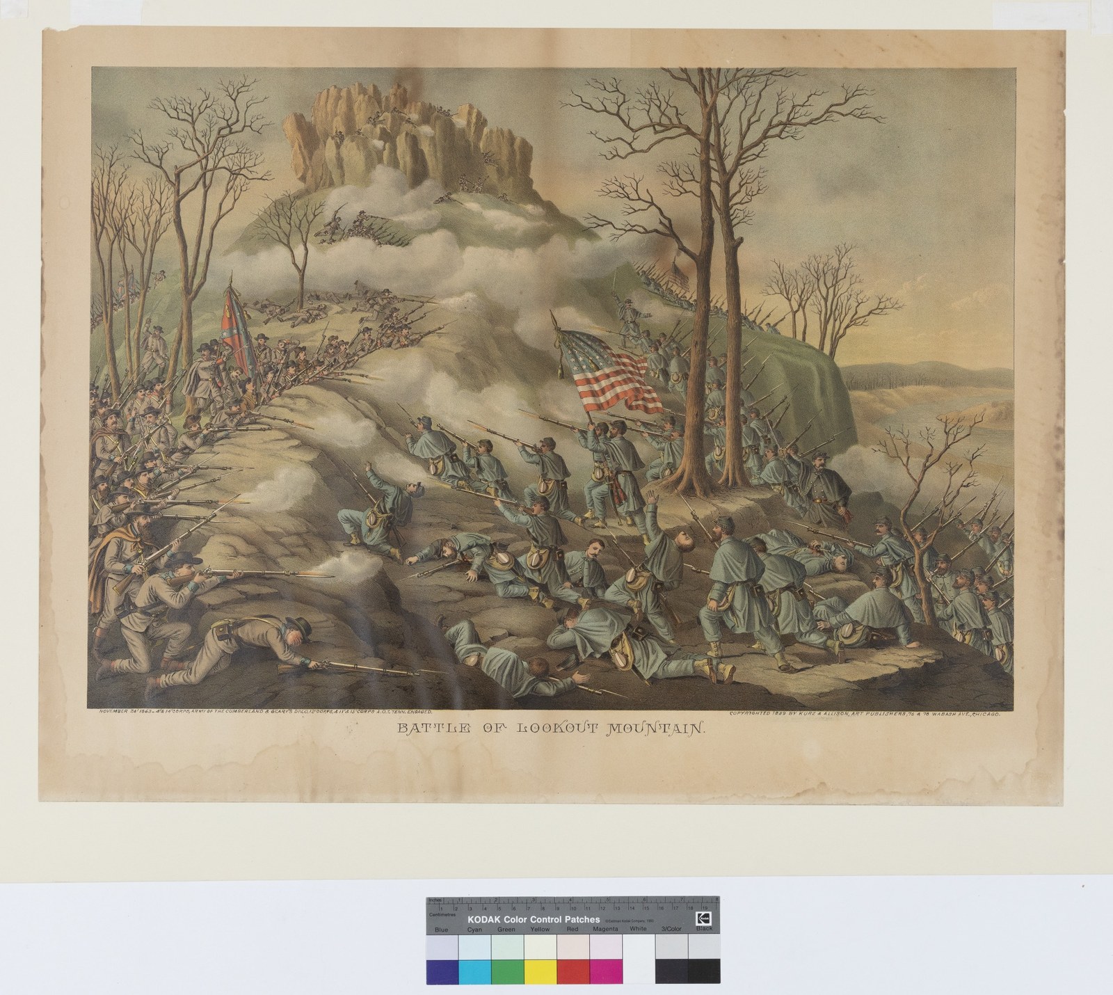
The war came closest in the fall of 1863, during the Chattanooga Campaign. The major battles, Lookout Mountain ("the Battle Above the Clouds," November 24) and Missionary Ridge (November 25), were fought just east of Marion County in Hamilton County. But Marion's river crossings, valley roads, and supply lines were integral to both armies' operations. Confederates under Braxton Bragg used the Tennessee River crossings near the county; Union General Joseph Hooker's command moved through the Lookout Valley corridor to reach Lookout Mountain. After the Confederate defeat, Federal forces controlled the Tennessee River through Marion County for the rest of the war.
Beyond the set-piece battles, the rugged plateau and gorge country made Marion County fertile ground for irregular warfare. Bushwhacker raids, cavalry sweeps, and retaliatory violence between Unionist and Confederate partisans persisted through 1864 and 1865, particularly along Battle Creek and in the coves of the Cumberland escarpment. The war's end left the county economically devastated, its young men dead or scattered, its farms stripped, its communities fractured by years of violence and divided loyalty.
Read more about the Civil War in Marion County →
The Battle of Sweeden's Cove, June 4, 1862 →
The Cracker Line, October 1863 →
Reconstruction
1865–1880
Emancipation in Tennessee came with the state's February 22, 1865 constitutional amendment, several months before the federal Thirteenth Amendment took effect. In Marion County, about 500 formerly enslaved people became legally free that spring while Confederate partisan violence on the plateau was still active. The Freedmen's Bureau operated field offices in Chattanooga and Jasper and intervened in labor contracts, investigations of violence against freedpeople, and school organizing. The East Tennessee Unionist coalition dominated Marion County politics through the late 1860s, and the county supported the Tennessee Republican Party into the 1870s before drifting Democratic with the post-Reconstruction South. Segregation by law emerged piecemeal between 1870 and the 1890s; a poll tax and later literacy and registration requirements disfranchised Black voters. The economic recovery of the Sequatchie Valley came slowly and mostly from outside: British investors organizing the Southern States Coal, Iron and Land Company in 1874, railroad rebuilding, and the first commercial coal shipments from Whitwell in 1876.
Read more about Reconstruction in Marion County →
Black History of Marion County →
The Industrial Boom
1870–1933
Reconstruction-era Marion County was poor and depopulated. Recovery came not from farming but from what lay underground. In 1874, British investors formed the Southern States Coal, Iron and Land Company to exploit the Sequatchie Valley's coal seams and nearby iron-ore deposits, after James Bowron Sr. had selected the South Pittsburg site as the syndicate's agent in 1873. By 1877, Bowron and his English associates had brought enough capital across the Atlantic to develop actual operations on the ground, and the county's transformation began.
By the 1890s, Marion County was an industrial landscape. Coal mines operated at Whitwell and Victoria. Coke ovens burned at Victoria, reducing coal to the fuel that iron smelters needed. Iron ore was hauled from mines near Inman. Smelters and foundries dominated South Pittsburg, which had been explicitly founded as an industrial city, its very name an aspiration. In 1886, Nashville banker William M. Duncan bought the South Pittsburg townsite and organized the South Pittsburg City Company; F. P. Clute platted the town; it was incorporated in 1887 with John G. Kelly as its first mayor.
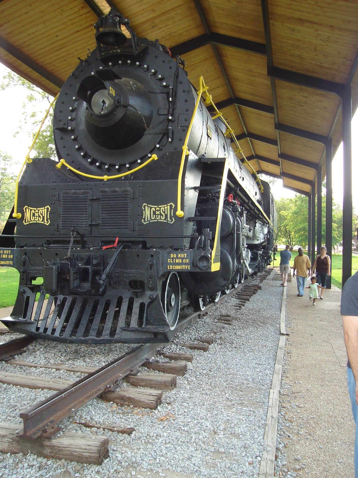
The engine of all this growth was the railroad. The Nashville, Chattanooga & St. Louis Railway (NC&StL) built the lines that connected Marion's mines and foundries to outside markets, running through the Sequatchie Valley and embedding the railroad in the origin stories of both Whitwell and South Pittsburg. Without the NC&StL, the coal and iron stayed in the ground.
In 1896, Joseph Lodge founded a cast-iron foundry in South Pittsburg, the company that would become Lodge Manufacturing, now the oldest family-owned cast-iron cookware maker in the United States. Unlike the mining operations that boomed and busted, Lodge proved durable. It has operated continuously in South Pittsburg for over 125 years and remains the county's largest private employer.
The boom years ran roughly from 1880 to 1920. Then the cycle turned. Coal and iron markets fluctuated, mines played out, and the extractive economy that had driven growth showed its fragility. State prohibition in 1909 and federal Prohibition in 1920 reshaped the plateau's informal distilling economy into a larger underground industry that coexisted with the declining coal-and-coke sector. The stock market crash of 1929 and the Great Depression devastated industrial Marion County. Company towns emptied. Families were thrown into poverty. The iron furnaces went cold.
Read more about the Prohibition era in Marion County →
The Depression & the New Deal
1929–1941
The Great Depression cut through Marion County's extractive industries directly, closing coke ovens at Victoria, idling coal mines at Whitwell, and shrinking the iron operations at Inman. Federal work-relief programs responded in waves: the Civilian Conservation Corps from 1933, the Works Progress Administration from 1935, the Tennessee Valley Authority also from 1933, and a series of paving and school-building contracts that rebuilt the county's rural road and school infrastructure through the late 1930s. The Highlander Folk School opened at Monteagle in November 1932 and trained generations of Southern labor and civil-rights organizers. A 1939 coal strike at Campbell Coal and Coke in Orme is one episode in the plateau's long UMWA-era labor history.
Read more about the Depression and New Deal era in Marion County →
Wars and military service: from the 668 men of World War I through Vietnam →
TVA & the Mid-Century
1933–1970
The Tennessee Valley Authority, created by Congress in 1933, reshaped both the landscape and the economy. TVA dams tamed the Tennessee River, generated hydroelectric power, controlled floods that had periodically devastated valley communities, and brought modern electricity to a region that largely lacked it. For Marion County, the TVA meant jobs when the Depression had gutted the mining economy, and it meant a fundamentally different relationship with the river.
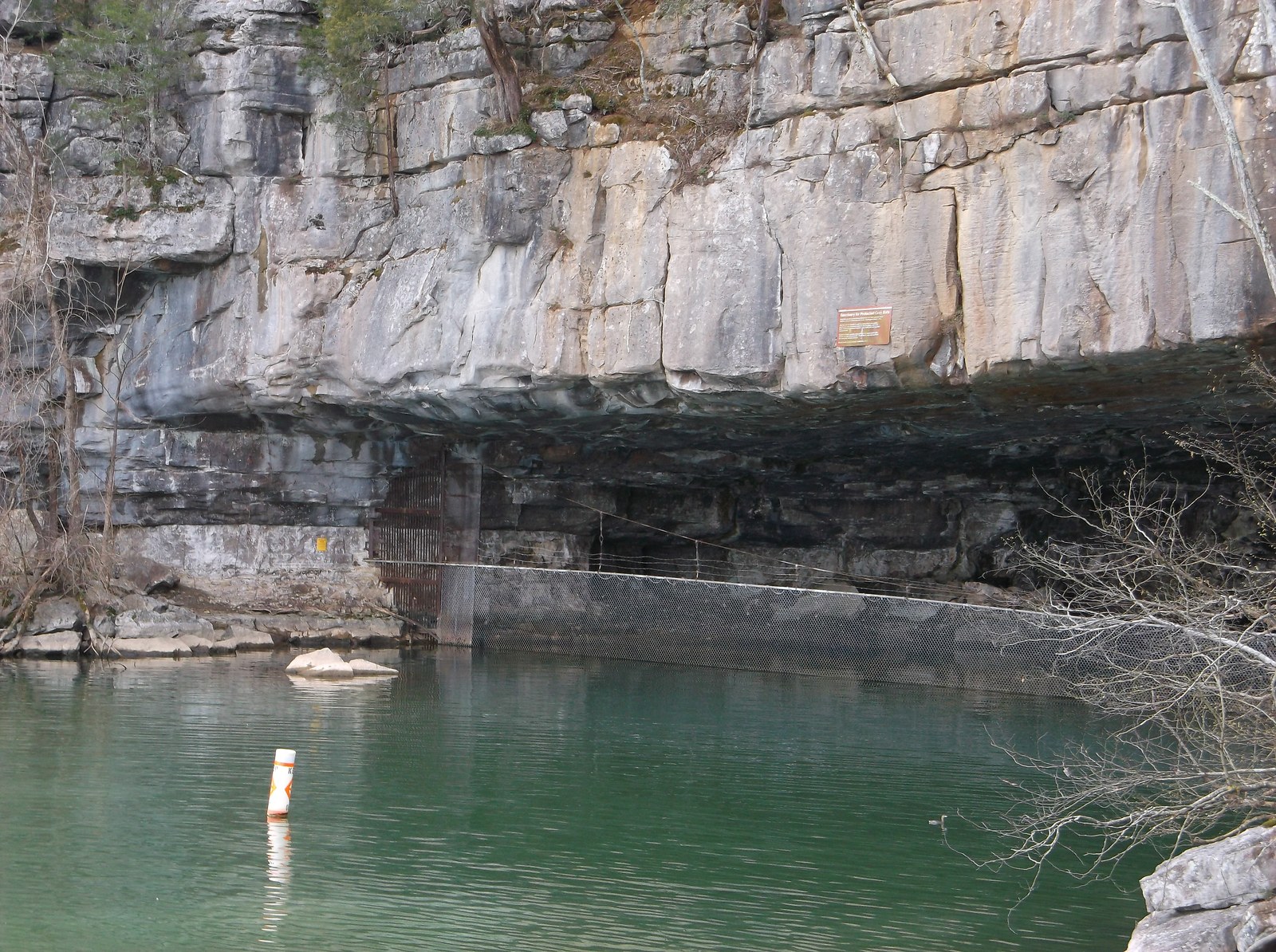
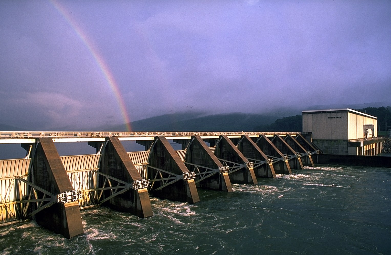
Hales Bar Dam, built in 1913 just east of the county in Hamilton County, had been an early attempt to manage the dangerous stretch of river through the gorge. It was replaced in 1967 by Nickajack Dam, which created Nickajack Lake, a major reservoir that smoothed the river, drowned the old rapids, and opened the area to recreation. The dam also partially flooded Nickajack Cave, threatening an important colony of federally endangered gray bats and prompting TVA to gate the cave entrance for their protection.
The other transformative infrastructure project of the era was Interstate 24, constructed through Marion County in the 1960s and 1970s. I-24 connected Chattanooga to Nashville across the Cumberland Plateau, passing over Monteagle Mountain and through the Sequatchie Valley. The highway broke Marion County's isolation, making it accessible for commuters, tourists, and distribution operations. Kimball, at the I-24/US-72 interchange, grew into the county's retail hub almost entirely because of the interstate.
Read more about the TVA era in Marion County →
The Modern Era
1970–Present
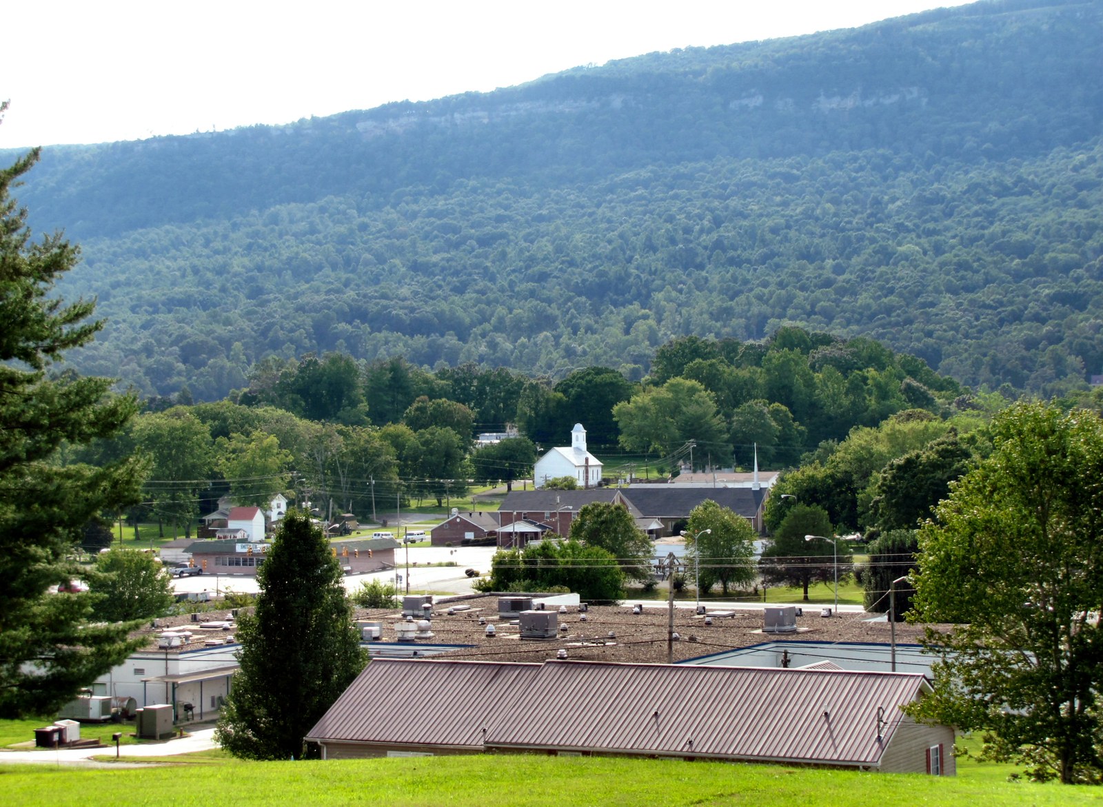
The last half-century has been a story of reinvention. The extractive industries are gone, the coal mines closed, the coke ovens cold, the iron smelters demolished. In their place: a diversified economy anchored by Lodge Cast Iron, auto-parts suppliers serving the Chattanooga manufacturing cluster, health care, construction, and a growing outdoor recreation and tourism sector drawn by Foster Falls, Denny Cove, the Tennessee River Gorge, Nickajack Lake, and the Sequatchie Valley Scenic Byway.
One of Marion County's best-known modern stories began in 1998, when eighth graders at Whitwell Middle School set out to collect six million paper clips, one for every Jewish victim of the Holocaust, as a way to grasp the scale of the tragedy. They ended up collecting over 30 million. The school acquired an authentic German railcar, the kind used to transport prisoners to concentration camps, and transformed it into the Children's Holocaust Memorial, unveiled on November 9, 2001, the anniversary of Kristallnacht. A 2004 documentary, Paper Clips, brought the project to a national audience, showing how a small rural Tennessee school engaged with the history of the Holocaust.
The county remains rural and closely tied to the land. Its population was 28,837 at the 2020 Census, part of the broader Chattanooga metropolitan area. Severe weather, including the 2011 Super Outbreak and the 2020 Easter tornado outbreak, has repeatedly affected the valley and plateau.
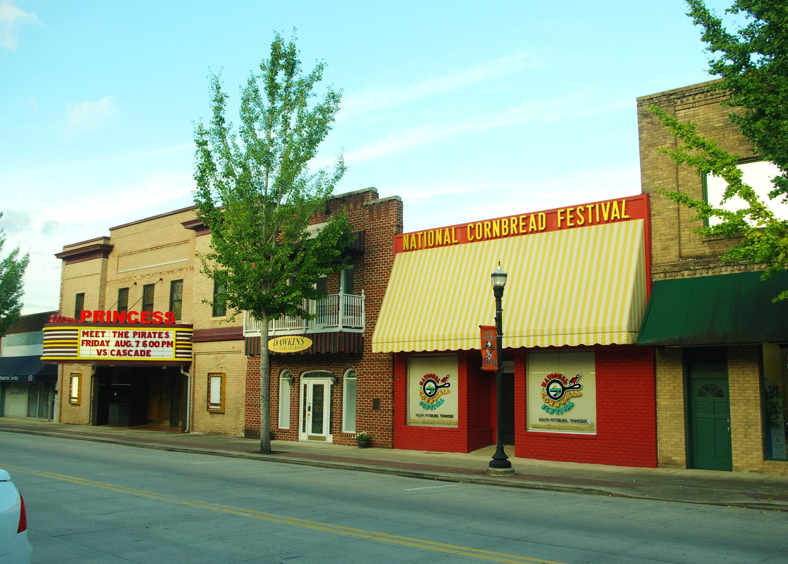
But Marion County endures. Lodge Cast Iron, entering its second century, has experienced a cultural renaissance as a new generation of home cooks rediscovers cast-iron cooking. The National Cornbread Festival draws thousands to South Pittsburg every April. The Cumberland Trail grows southward along the plateau rim. And the Sequatchie Valley, the narrow, ridge-hemmed corridor that has shaped life here for centuries, remains as it was: quiet, rural, and defined by the land.
Subpages
Twenty-three dedicated subpages treat specific topics, events, and eras in Marion County history in more depth than the chronological narrative above allows.
In the Beginning
The valley's first peoples across nine thousand years: the Archaic hunters, the Woodland mound builders, the Mississippian villages, and the archaeologists who read the record.
Russell Cave
The cave below South Pittsburg whose floor held a 9,000-year record of human life, excavated in 1956 by local coal miners and the Smithsonian.
The Early Explorers
The Spanish entradas of De Soto (1540), Luna (1560), and Pardo (1567), the first Europeans known to reach the Tennessee River country around Marion County.
Chiaha
The river-island town where De Soto rested in 1540, and the long debate over whether it stood at Burns' Island, Williams Island, or the French Broad.
The Native American Trails
The Black Fox, Sequatchie, Nickajack, Chickamauga, and Great Indian Warpath routes that met at the Old Creek Crossing ford below Long Island.
The Cherokee Lower Towns
Nickajack, Running Water, and Crowmocker: the Chickamauga Cherokee communities in Marion County between 1779 and 1794.
The Chickamauga Wars
Dragging Canoe's eighteen-year military campaign, 1776 to 1794, with the Marion County Lower Towns as its strategic capital.
The Nickajack Expedition
The September 1794 militia raid that burned Nickajack and Running Water, ended the Chickamauga Wars, and opened the area to American settlement.
County Formation (1817)
The Cherokee treaty that opened the Sequatchie Valley, the legislative act, the first court at John Shropshire's house, Betsy Pack's land sale for the Jasper courthouse, and the courthouses that followed.
The First Settlers
The earliest non-Cherokee settlers of Marion County, the cove-by-cove chronology of Anglo-American arrivals, and the Cherokee reservees who held land alongside them from 1819 to 1838.
The Trail of Tears
The 1838 forced removal of the Cherokee Nation through Marion County: the Bell detachment at Martin Springs, the Benge route north of the county, and Betsy Pack's removal from Alabama.
The Battle of Sweeden's Cove
The June 4, 1862 Union cavalry victory that opened Marion County's Civil War and left roughly twenty unidentified Confederate graves at the Bean-Roulston Cemetery.
The Civil War in Marion County
Divided loyalties, Fort McCook, Sweeden's Cove, the Chattanooga Campaign, the Cracker Line, and the bushwhacker war on the Cumberland escarpment.
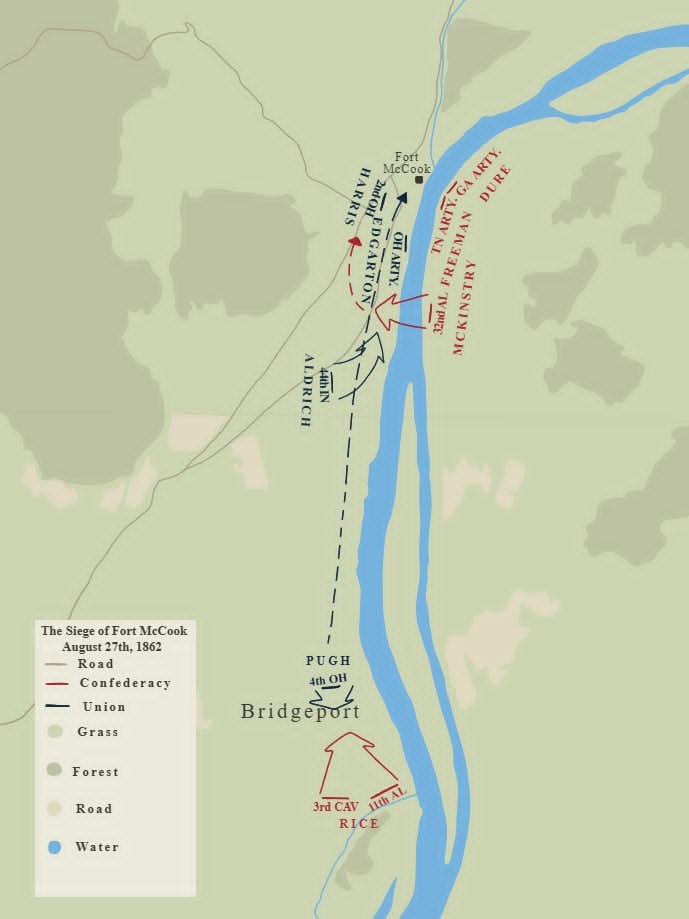
Fort McCook on Battle Creek
The Union earthwork at the mouth of Battle Creek: built in summer 1862 by McCook's and Crittenden's divisions, shelled out by Maxey on August 27, briefly held as Fort Maxey, and reoccupied as Fort Thomas during Brannan's September 1863 crossing.
The Cracker Line
The October 1863 supply operation that broke the siege of Chattanooga, with the steamer Chattanooga docking at Kelley's Ferry in western Marion County.
Reconstruction in Marion County
Freedpeople and the Freedmen's Bureau, Unionist political ascendancy, early segregation, and the economic groundwork for the industrial era.
Black History of Marion County
Enslaved labor in the antebellum era, USCT soldiers, the Freedmen's Bureau, segregation-era schools and churches, McReynolds High School, and the modern Black community.
The Civil Rights Era
Late Jim Crow, school desegregation, the 1965 McReynolds fire, the Voting Rights Act, and the transition to integration in Marion County, roughly 1954 to 1975.
The Prohibition Era
Tennessee's Four-Mile Law, the 1909 state prohibition, the 1920 to 1933 federal Prohibition, and the plateau moonshine economy that ran alongside.

The Depression & the New Deal
Industrial collapse on the plateau, the 1932 founding of the Highlander Folk School at Monteagle, CCC and WPA projects, and the 1939 Orme coal strike.
Wars & Military Service
The 668 men of World War I, two Medal of Honor recipients in World War II and Korea, the Vietnam-era dead, and the four courthouse memorials that carry their names.
The TVA Era
Rural electrification, the retirement of Hales Bar Dam, the 1967 Nickajack Dam, the displacement of Mullins Cove and Shellmound families, and the gating of Nickajack Cave for gray bats.
The Modern Era
Deindustrialization, Lodge Cast Iron's reinvention, the I-24 corridor, Jasper Highlands, Sweetens Cove Golf Club, the Paper Clips Project, and Marion County in the twenty-first century.
Sources
- Marion County — Tennessee Encyclopedia
- Marion County, Tennessee — Wikipedia
- Chickamaugas — Tennessee Encyclopedia
- Nickajack Expedition — Wikipedia
- Nickajack Cave — Wikipedia
- Jasper, Tennessee — Wikipedia
- Genealogical Fact Sheets — TN Secretary of State / State Library & Archives
- The Battle of Sweeden's Cove — Lancaster at War
- Chattanooga Campaign — Wikipedia
- Battle of Lookout Mountain — Wikipedia
- Tennessee Civil War Battles — National Park Service
- South Pittsburg, Tennessee — Wikipedia
- Lodge Cast Iron — About Lodge
- Nickajack Dam — Structurae
- Paper Clips Project — Wikipedia
- Trail of Tears — Wikipedia
- Chickamauga Cherokee — Wikipedia
- Tennessee Valley Authority — Wikipedia
- Highlander Folk School — Wikipedia
- Reconstruction — Tennessee Encyclopedia
- Prohibition — Tennessee Encyclopedia
- Marion County, TN — Data USA