Last updated: April 23, 2026
- Type: Historic unincorporated community
- Status: Small residential and recreation area along Nickajack Lake
Shellmound is a historic populated place along the Tennessee River in the southeastern part of Marion County, on the north bank of the river just upstream from Nickajack Dam. Its name comes from the large freshwater mussel shell middens that once marked native occupation sites along this stretch of the river, mounds of discarded shells accumulated over centuries of indigenous use.
Setting
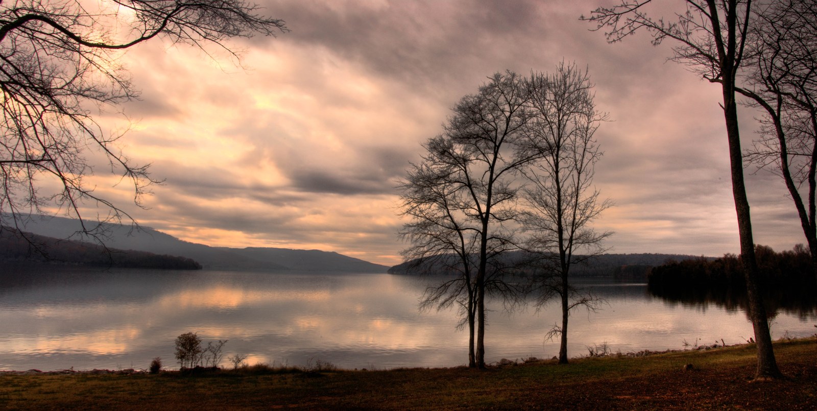
Shellmound lies on the north bank of the Tennessee River in the deep gorge between Sand Mountain to the south and Raccoon Mountain to the north, just upstream from Nickajack Dam and downstream from the former Hales Bar Dam site at Haletown and Guild. The ground falls away from the plateau rim in a narrow strip of bottomland between the river and the mountain wall, with the old Nashville, Chattanooga & St. Louis rail line running along the flat. Before the completion of Nickajack Dam in 1967, the river ran fast and shallow here; today the same ground is lakeshore. The community takes its name from the freshwater mussel shell middens, accumulated over centuries of indigenous occupation, that once marked the riverbank. Most of those middens are now either buried under fill or submerged by Nickajack Lake.
Cherokee and pre-Cherokee presence
The shell middens that gave Shellmound its name are archaeological evidence of a sequence of Indigenous occupation running back thousands of years. Freshwater-mussel middens along the Tennessee River are characteristic of Archaic-period (roughly 8000 to 1000 BC) riverine fishing and shellfishing camps, and the continued use of this stretch of the gorge is reflected in Woodland pottery and later Mississippian material recovered from the middens and surrounding bottomlands before the mid-20th-century flooding. The accumulation of discarded shell, fire pits, and burials that once stood above the river here was one of the largest visible prehistoric sites in southeast Tennessee and the direct source of the place name.
By the late 18th century, the ground was part of the Cherokee homeland and lay inside the orbit of the Five Lower Towns, the stronghold of the Chickamauga Cherokee under Dragging Canoe. The specific towns of Nickajack and Running Water sat a short distance west, at the mouth of Nickajack Cave and along Running Water Creek, and the fishing, fording, and travel patterns that used the Shellmound bend would have been part of the daily life of those towns. Both towns were destroyed in Major James Ore's Nickajack Expedition of 1794.
Cherokee use of this stretch of the river did not end with 1794. Under the Treaty of 1819, several Cherokee families took 640-acre reservations along Battle Creek and nearby bottoms; others continued to hold ferry crossings and small farms in the gorge until they were pressed off their land in the 1820s or forcibly removed from the county during the 1838 Trail of Tears. The Cherokee Nation, today a sovereign nation headquartered in Oklahoma, traces its origins in part to the families that were living along this river. Most of the shell middens themselves were obscured, quarried for road fill, or submerged by the Nickajack Lake impoundment in 1967, and the archaeological record that survived into the 20th century has been significantly diminished; the place name is the most enduring public record of the site's long pre-Anglo-American history.
Railroad and river crossing
A Nashville, Chattanooga & St. Louis Railway depot served Shellmound, making it a stop along the main line that carried traffic through the Tennessee River Gorge between Bridgeport and Chattanooga. Before modern bridges, Rankin's Ferry carried wagons and foot traffic across the river between Guild and Shellmound, operating well into the late 1920s. The Marion Memorial Bridge, built in the early 1930s, replaced the ferry; it was closed to traffic on January 9, 2012 and demolished in 2015, with a new river crossing opening just upstream in November 2014.
Civil War
Shellmound's position on the Tennessee River and the main rail line made it strategically important during the Civil War. Union forces of the Army of the Cumberland crossed the Tennessee River at multiple points west and south of Chattanooga in late August and early September 1863 during the Chickamauga Campaign, and Shellmound was one of the crossings. Two months later, in late October and early November 1863, Major General Joseph Hooker's XI and XII Corps divisions moved through the gorge along the NC&StL railroad on the Bridgeport-to-Chattanooga route that opened the Cracker Line supply route to the besieged city. Local histories place skirmishes at Shellmound and at the Narrows just east of town during these operations, though the exact dates vary between accounts.
Inundation and present day
With the completion of Nickajack Dam on December 14, 1967, Shellmound's river frontage became lakeside. The new reservoir, Nickajack Lake, submerged the shell middens and raised water levels along the south bank. Today the area hosts a TVA Shellmound Recreation Area and campground, lakeside homes, and residential neighborhoods. The archaeological significance of the historic middens is largely obscured or submerged, but the place name preserves the memory.
Landmarks
- Shellmound Recreation Area (TVA, on Nickajack Lake)
- Nickajack Lake waterfront
Related
In the Beginning: prehistory of the valley (Moore's Shellmound shell heaps) →
The Native American trails and the Old Creek Crossing →
Chiaha →
Nickajack & Running Water →
The TVA era in Marion County (Shellmound shell midden inundation) →
Nickajack Cave, Lake & Dam →
Transportation history →