Last updated: June 3, 2026
- Length: approximately 116 miles
- Drainage basin: approximately 602 square miles
- Headwaters: Head of Sequatchie springs, Devilstep Hollow, Cumberland County
- Mouth: Tennessee River (Nickajack Lake) near Kimball, Marion County
- Principal tributary: Little Sequatchie River (enters near the community of Sequatchie)
- Counties drained: Cumberland, Bledsoe, Sequatchie, and Marion
- Dams: None (unregulated)
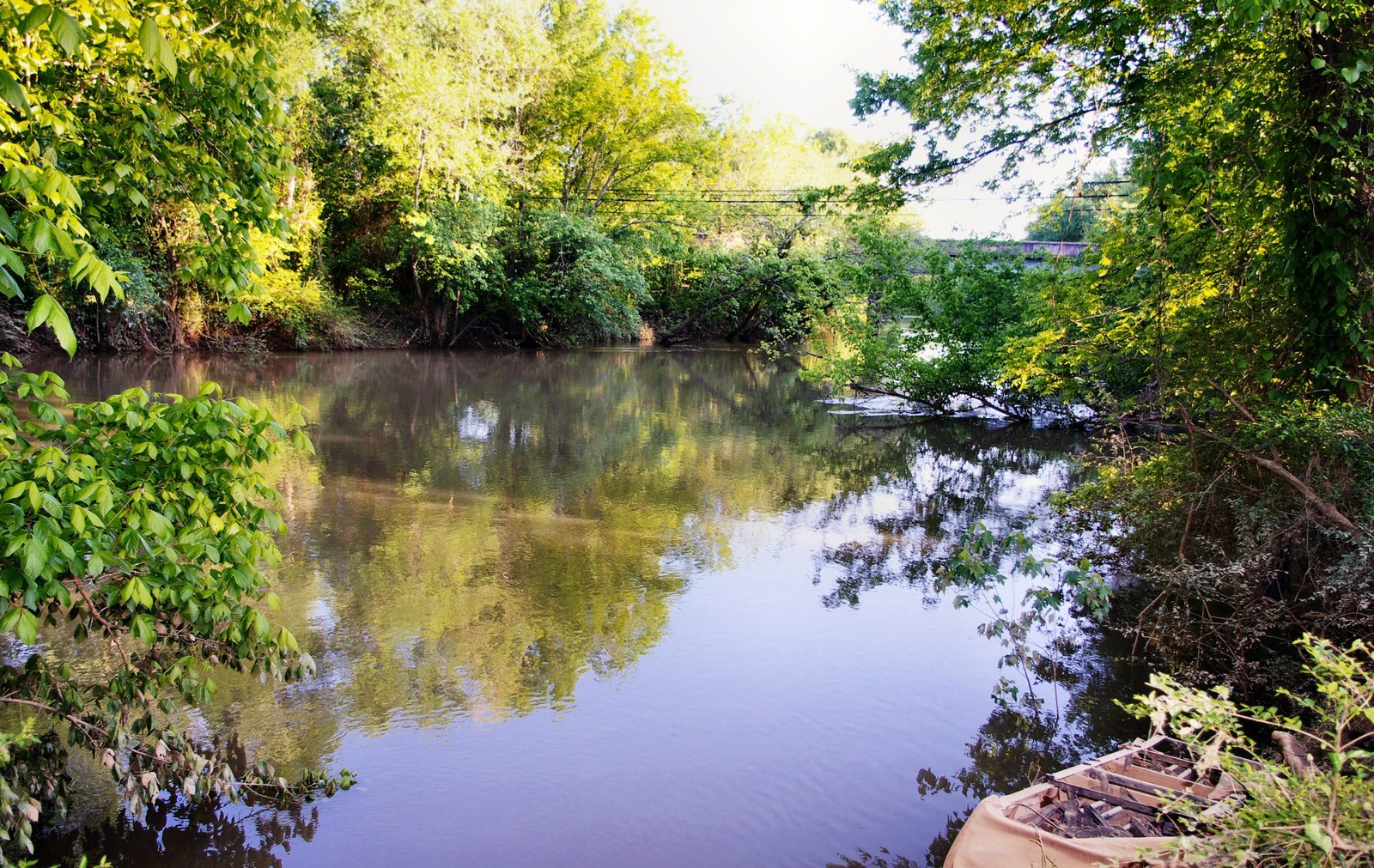
The Sequatchie River is the largest stream entirely within the Sequatchie Valley and the river the valley is named for. It drains a ~602-square-mile basin through four Tennessee counties and enters the Tennessee River near the community of Kimball in Marion County. The Sequatchie is unique among the larger Tennessee tributaries in that it is unregulated: no dam has ever been built on it, and it is the only significant rain-driven tributary of the Tennessee that still runs free from headwaters to mouth. Its flow is shaped instead by karst hydrology; most of the river's base-flow originates from springs that rise at the limestone floor of the valley, with much of the water having entered the plateau surface miles upstream and travelled underground to its resurgence.
Headwaters and course
The Sequatchie originates at the Head of Sequatchie, a group of large karst springs at the base of Devilstep Hollow Cave in Cumberland County, just outside the Marion County research footprint. Dye-trace studies have established that the spring water originates in Grassy Cove, a large limestone sinkhole northeast of the valley, where surface streams disappear underground, travel for several miles beneath the plateau, and reemerge at the Head of Sequatchie as the river's first surface flow. The headwater springs are protected as part of Cumberland Trail State Park, and a short Falcon Warrior interpretive trail leads visitors to the spring.
The link between Grassy Cove and the river's headwaters was folk knowledge long before it was science. Grassy Cove is an encircled karst basin, roughly five miles long and two miles wide and some five hundred feet below the surrounding Cumberland Plateau, ringed by Hinch, Brady, and Bear Den mountains; its surface streams sink underground and travel beneath the mountains to reemerge at the Head of Sequatchie. In the early days of settlement, the grist mills of the upper valley depended in dry seasons on water released from a mill pond in the cove, and according to local folklore the millers would send word over the mountain, "Please throw a few buckets of water over the dam so's we can grind." In 1961 the Tennessee Valley Authority and the U.S. Geological Survey put the old belief to a test, dropping brightly painted wood chips and a harmless dye into the waters of Grassy Cove at hourly intervals. After six days the chips and dye surfaced in the spring at the head of the valley, proving that the Sequatchie does rise in Grassy Cove, its current slowed, the engineers reasoned, by a quiet pool or series of pools hidden beneath the mountain. The account here follows Raulston and Livingood's Sequatchie (1974); the cove's karst is now a National Natural Landmark.
From the Head of Sequatchie, the river flows southwest for roughly 116 miles through Bledsoe, Sequatchie, and Marion counties. Its drop through the valley is gentle, dropping only a few hundred feet over the entire course. The river's Marion County reach begins near the community of Sequatchie, where the Little Sequatchie River joins from the west; passes through Whitwell, Powell's Crossroads, Griffith Creek, and Jasper; and empties into the Tennessee River at Kimball on the east side of town. Beyond the Little Sequatchie, the river gathers a long list of smaller branches rising in the valley's springs and coves, among them Henson, Hicks, Hendricks, Stone Cave, Thurman, Woodcock, Big Brush, Crystal, and Skillern creeks; Raulston and Livingood note that about three-fifths of the river's roughly 600-square-mile basin is mountain terrain rather than valley floor. The confluence was once roughly two miles upstream of the Alabama line, but the 1967 filling of Nickajack Lake pushed the hydrologic boundary somewhat upstream; in high-water events the reservoir backs up the last mile or two of the Sequatchie's flow.
Hydrology and gauge data
The U.S. Geological Survey maintains the Sequatchie River near Whitwell streamgage (USGS 03571000), the county's only continuously recording stream gauge, in operation since 1920. Average annual discharge at Whitwell is approximately 745 cubic feet per second, with substantial seasonal variation: the low-flow of 16 cfs was recorded in September 1925, and the instantaneous peak of 32,500 cfs was recorded during the March 1973 floods. Because the river is karst-fed, base flows during dry periods are notably steady compared to surface-runoff streams of similar basin size; during drought years the river shrinks but does not dry. During intense-rain events, however, the valley's relatively narrow floodplain and the tributary karst springs' capacity limits can produce rapid rises. The National Weather Service flood-stage thresholds at Whitwell sit at 21 feet for minor flooding and 24 feet for moderate flooding; the Sequatchie has historically exceeded these levels during Tennessee Valley Easter-week storm systems, including the April 2020 event that damaged four bridges in the Whitwell and South Pittsburg vicinity.
Why the river has no dam
Despite three TVA studies of potential impoundment in the Sequatchie Valley between the 1930s and 1960s, no dam was ever built. The reasons were a combination of economics and geology: the karst foundation of the valley floor meant any dam site would face leakage problems similar to those that plagued Hales Bar on the Tennessee, and the valley's relatively low population and power demand did not justify the capital cost. The Nolichucky, Clinch, French Broad, Holston, Elk, and Duck rivers all received TVA reservoirs during the dam-building era; the Sequatchie did not. Today, the Sequatchie is one of the longest free-flowing rivers in Tennessee and is used as a reference reach for unimpaired southern Appalachian karst hydrology. That status has ecological consequences: the river hosts native fish, mussel, and invertebrate assemblages that are disrupted or lost on dammed Tennessee tributaries.
The name
Sequatchie is a Cherokee-derived name. Nineteenth-century sources vary in spelling, Siquatchi, Se-qua-chee, Se-qua-cha-ha-hok, and in translation; common interpretations include "opossum" (the animal common in the valley) and "hog river" (for the wild pigs that roamed the valley bottoms). The -cha-ha-hok form has been read as "where the river runs from the earth," reflecting the karst-spring headwaters at the Head of Sequatchie. The historian James Mooney identified the root in a Cherokee phrase meaning "grinning opossum" in his 19th-century work on Cherokee place names, but the original Cherokee pronunciation is no longer certain; what is consistent across sources is that the name is pre-Anglo, Cherokee in origin, and applied to both the river and the valley from the earliest documented use.
Raulston and Livingood, in Sequatchie (1974), trace the same disagreement through the early authorities. The historian John Haywood gave the Cherokee Su-quah as "hog" and Su-qua-oo-chas-tie as "opossum"; John P. Brown rendered the name sikwa'utset'tsi, "o'possum, he grins"; and James Mooney set the animal readings aside altogether, deriving Sequatchie from Si'gwetsi, a Cherokee settlement on the French Broad River where the stone for white peace pipes was quarried. The local folk version simply makes Sequatchie Valley mean "hog trough." The river itself carried other names in the earliest records: it appears as Crow Creek in some early English documents and as the Ocoee River on some aboriginal maps. Raulston and Livingood also record a tradition that the valley was named for a Cherokee chief of the area, "known to history only for his treaty-signing activities with the whites," an early spelling of whose name was Sequachee.
Ecology
The Sequatchie's largely free-flowing channel supports a different fish community than the impounded Tennessee River main stem at Marion. Signature game fish include smallmouth bass, the river's most pursued sport fish, alongside rock bass and longear sunfish. Clear gravel-bottomed runs also support multiple darter species sensitive to siltation. Several minnows, shiners, dace, and stonerollers round out the small-fish community adapted to clear, cool, moderately swift, limestone-fed streams. The river's freshwater mussel assemblage is less diverse than the historic Tennessee River main stem but includes species sensitive to sedimentation and dam fragmentation, the reason the unregulated Sequatchie remains ecologically significant. Beaver and river otter have recolonized the Tennessee River drainage following twentieth-century declines, and both species are present along the Sequatchie. Cerulean warblers and Louisiana waterthrushes breed along wooded corridors; belted kingfishers are year-round residents. The Sequatchie's karst-spring tributaries support the endemic species covered on the endemic species page, including the federally endangered Royal Snail at Blue Spring and Owen Spring.
Human uses
Historically the Sequatchie provided water for agriculture, mills, and early industry along the valley floor. Ketner's Mill, a surviving 1882 brick mill near Victoria, is the most visible survivor of the 19th-century grain-milling economy that used the river. Cattle grazing, row-crop farming (corn, hay, soybeans), and hayfield irrigation remain the principal consumptive uses of the river today. The river is a popular paddling destination through parts of its Marion County reach, with public access at the Whitwell Town Park and additional access at bridges and agricultural crossings. Trout are not native and are not stocked in the Sequatchie itself; cool-water fishing is concentrated on smallmouth bass and rock bass. The Tennessee Wildlife Resources Agency (TWRA) classifies the Sequatchie as a warm-water stream for fishery management.
The Little Sequatchie River
The Little Sequatchie River is the Sequatchie's principal tributary in Marion County, entering from the west at the community of Sequatchie. It rises on the Cumberland Plateau in Grundy County, descends through a series of waterfalls along the escarpment (including falls in the Tracy City vicinity), and runs the last several miles across the valley floor to the confluence. Sequatchie Cove Farm and Sequatchie Cove Creamery operate along the Little Sequatchie, and the USGS 2024 karst groundwater report documented that the Little Sequatchie's base flow is supplied in part by subsurface diversions from the Pryor Cove watershed, not just its surface catchment. The Little Sequatchie joins the main stem near the Sequatchie community and contributes a substantial fraction of the main river's flow in Marion County.
Related
About the Sequatchie Valley →
About the Tennessee River →
About Marion County geology →
About the Cumberland Trail and Head of Sequatchie →
About endemic and notable species →
Sources
- Wikipedia — Sequatchie River
- Wikipedia — Little Sequatchie River
- USGS — Sequatchie River near Whitwell, TN (stream gauge 03571000)
- NWS Morristown — Sequatchie River near Whitwell (flood stages)
- USGS SIR 2024-5089 — Karst groundwater flow paths in Little Sequatchie and Pryor Cove
- Tennessee State Parks — Head of Sequatchie
- TWRA — Fishing in Tennessee
- Sequatchie Valley Scenic Byway
- Wikipedia — Grassy Cove (National Natural Landmark; the subterranean drainage to the Head of Sequatchie)
- J. Leonard Raulston and James Weston Livingood, Sequatchie: A Story of the Southern Cumberlands (Knoxville: University of Tennessee Press, 1974), chapter 2, "Visitors and the Land," pp. 16–19 (the 1961 Grassy Cove dye test, the river's alternate names, and the name authorities).