Last updated: April 28, 2026
- Created: November 20, 1817, by Acts of the Tennessee General Assembly
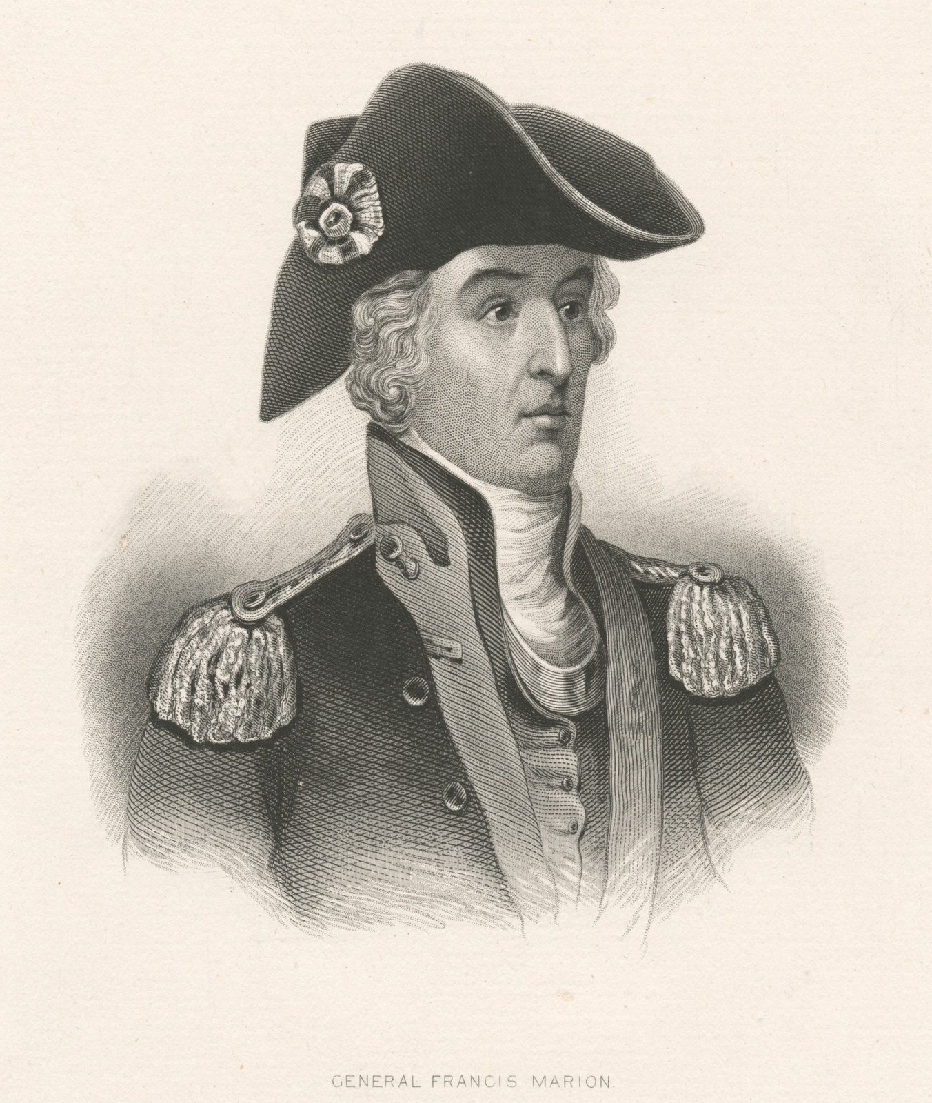
- Named for: Brigadier General Francis Marion (c. 1732–1795), the "Swamp Fox" of the American Revolution
- Enabling treaty: Treaty at the Cherokee Agency, July 8, 1817 (7 Stat. 156)
- Predecessor counties: carved from Bledsoe County and Cherokee-ceded territory south of it
- First court: at the house of John Shropshire, in what is now Whitwell
- County seat: Jasper, selected 1819, named for Sergeant William Jasper of the American Revolution
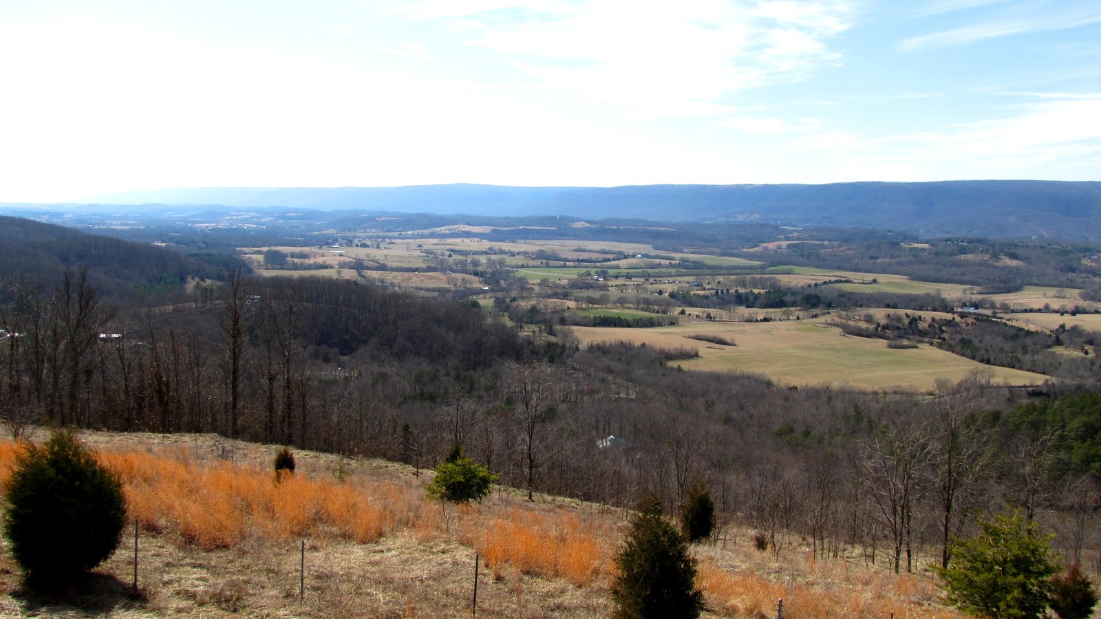
- Area: approximately 500 square miles
Marion County exists because a Cherokee treaty, a Tennessee statute, and a federal ratification converged in the last weeks of 1817. The treaty ceded the lower Sequatchie Valley. The statute carved a new county from the ceded land. The ratification made both effective. Within two years, commissioners had chosen a county seat, a Cherokee woman had sold forty acres for a courthouse site, and a permanent government was taking shape on the ground that is still the Jasper courthouse square today. This page traces the sequence from the treaty through the early courthouses, with the open questions the sources leave behind.
The Cherokee treaty
The land that became Marion County was part of the Cherokee Nation until the summer of 1817. On July 8 of that year, Cherokee leaders and three United States commissioners, Major General Andrew Jackson, Tennessee Governor Joseph McMinn, and General David Meriwether, signed the Treaty at the Cherokee Agency (also called the Treaty with the Cherokee, 1817, or the Jackson-McMinn Treaty). Return J. Meigs served as Cherokee Agent. Among the Cherokee signatories were Richard Brown, Cabbin Smith, George Lowry, Charles Hicks, Going Snake, and John Walker.
Article 2 of the treaty ceded a block of land "lying north and west of" a boundary line that ran from the top of Walden Ridge, where it divides the waters of the Tennessee River from those of the Sequatchie River, southward along the ridge to the bank of the Tennessee near a place called the “Negro Sugar Camp,” then westward to the mouth of Little Sequatchie River, up that river to its main fork, up its northernmost fork to its source, and due west to the existing Indian boundary line. This was the specific Sequatchie Valley cession that opened the ground for Marion County. The treaty was part of a larger exchange: Cherokee who wished to remain east kept reduced territory; those who wished to migrate west received land on the Arkansas and White rivers.
The full treaty text survives in Kappler's Indian Affairs: Laws and Treaties, Volume II, pages 140 through 144, and is available on the TNGenWeb Indian Cessions archive.
The 1817 treaty should not be confused with two related but distinct cessions. The Treaty of Tellico (1805) had ceded upper Sequatchie Valley lands, enabling Bledsoe County's expansion northward. The Treaty of Turkeytown (September 14, 1816) ceded Cherokee lands in northwestern Alabama south of the Tennessee River and west of the Coosa River, roughly 3,500 square miles, but did not include the Marion County territory. The later Calhoun Treaty (1819), sometimes called the Hiwassee Purchase, opened additional Cherokee lands east of the 1817 cession line, creating the Ocoee District and enabling McMinn, Hamilton, and Monroe counties. Marion County was created under the 1817 treaty, not the 1819 Hiwassee Purchase.
The legislative act
On November 20, 1817, the Tennessee General Assembly passed "An Act to establish a new county south west of Bledsoe and south of Warren and Franklin counties." The act named the new county for Brigadier General Francis Marion (1732–1795), the South Carolina militia leader whose guerrilla tactics during the American Revolution earned him the nickname "the Swamp Fox." Marion never visited Tennessee; the county is one of at least seventeen across the United States that bear his name.
The act carried a conditional clause: it "shall take effect only after the treaty made with the Cherokee Indians shall have been ratified by the government of the United States." The treaty was proclaimed on December 26, 1817, making the county effective by the end of that year. The act's boundary description began at the Northwest Mountain at the fork of Brush Creek where the road from Bledsoe County to Warren County crossed it, ran down Brush Creek to its mouth, then up the Sequatchie River to the mouth of Prigmor's Powder Mill Creek, and continued through various geographical landmarks to define the county's roughly 500-square-mile territory.
Sources differ on the chapter number of the act. The Tennessee State Library and Archives (TSLA) genealogical fact sheet for Marion County cites "Acts of Tennessee 1817, Chapter 10." The University of Tennessee County Technical Assistance Service (CTAS) and the existing published references cite Chapter 109. Both are authoritative state sources. The discrepancy has not been resolved; the full act text on the CTAS website could clarify the matter. For now, both chapter numbers are noted.
Pre-county settlement
Before the act passed, settlers had already crossed into the southern Sequatchie Valley. When Tennessee became a state in 1796, the valley was part of Roane County. The upper end was established as Bledsoe County in 1807, which technically included all of the valley, but treaties with the Cherokee kept white settlers out of the lower end. Despite the treaty boundary, the first non-Cherokee settlers are thought to have arrived around 1805: Amos Griffith and brothers William and James Standifer, according to the Tennessee Encyclopedia. Nonie H. Webb's restored historical map offers an alternate dating of 1794, though this claim has not been independently verified. Either way, these families settled in Cherokee territory years before the 1817 cession made their presence legal. For a fuller treatment of the pioneer arrivals, the cove-by-cove settlement chronology, and the Cherokee reservees who held land alongside them, see the First Settlers subpage.
The first court and early government
The act directed that courts of pleas and quarter sessions, and the circuit court, be held "at the house of John Shropshire, until otherwise provided for." Shropshire's house stood in what is now Whitwell. The Tennessee Encyclopedia notes that the first court at this site may have predated the formal county creation, with court having been held "while this county was still in North Carolina" at the Cheek house.
After the initial term at Shropshire's house, court was held for one year at the Cheek house, "a two-story double log house located south of Whitwell in a place called Cheekville, later named Liberty," according to the Tennessee Encyclopedia. The site's Cheekville page identifies Cheekville as essentially the same place as modern Whitwell, but the Tennessee Encyclopedia places it "south of Whitwell." Whether this reflects a real geographical distinction or simply imprecise location descriptions is an open question.
The first county officials took office in 1820. The TNGenWeb Marion County officials roster and the Tennessee Encyclopedia record four names: John Kelly as Clerk of the Court, the county's first registrar (given as "Alan Griffith" in both the Tennessee Encyclopedia and the TNGenWeb roster, though the 1805 first-settler "Amos Griffith" may be the same person under a variant spelling), Jesse Beene as Circuit Court Clerk, and James Jones as Sheriff. Whether "Amos" and "Alan" Griffith are the same individual, a transcription variant across sources, or two different Griffiths has not been resolved.
Selecting the county seat
In 1819, the General Assembly appointed seven commissioners to choose a permanent county seat: William Stone, David Oats, Burgess Matthews, Alexander Kelly, William King, William Stevens, and Davis Miller. They selected a site in the central valley and named it Jasper, in honor of Sergeant William Jasper, a hero of the American Revolution from South Carolina who died at the Siege of Savannah in 1779.
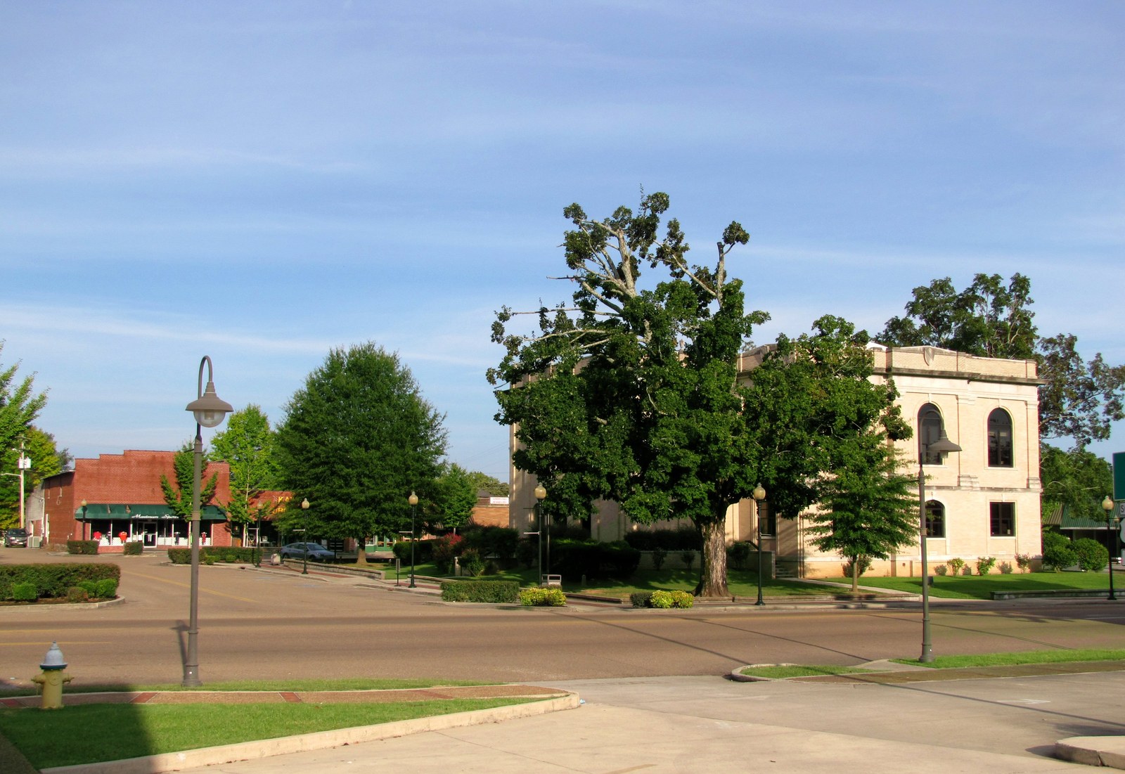
The land for the courthouse came from Betsy Pack, a Cherokee woman who sold the commissioners forty acres. The Tennessee Encyclopedia records that "the courthouse built in 1820 was near the center of the tract where the present one now stands." The South Pittsburg Historic Preservation Society's markers page lists a Betsy Pack marker at the courthouse square, and the site's people page covers her story in more detail. The Historical Marker Database likely has the verbatim Tennessee Historical Commission plaque text, which has not yet been retrieved.
The courthouses
Marion County has had three courthouses on the Jasper square, all on or near the center of the original Betsy Pack forty-acre tract.
The first courthouse was a log or frame structure. Sources differ on its completion date: the Tennessee Encyclopedia says "the courthouse built in 1820," while the site's demographics page, drawing on the South Pittsburg Historic Preservation Society's Jasper page, gives 1824 and names John Mathas as the builder. The two dates may refer to different structures — a temporary log courthouse in 1820 followed by a permanent building in 1824.
The second courthouse was built in 1880 by John Jones. It served the county for over four decades until the courthouse fire of 1922 destroyed the building and, with it, the county's earliest official records. County court minutes are missing and presumed lost in the fire.
The third and current courthouse, a buff-colored brick and concrete structure, was completed in 1925 on the same square. It faces north, stands two stories, and features arched windows and an entrance pavilion. In 1984, the building suffered fire damage. It was remodeled in 1986 by Volkhart Architects of Chattanooga, with Warren Construction as contractor. The 1984 fire and 1986 remodel are documented in the American Courthouses project and the Tennessee Administrative Office of the Courts but have not previously appeared on this site.
The Sequatchie County split
On December 9, 1857, the General Assembly carved Sequatchie County from two northern districts of Marion County and one district of Bledsoe County. Residents of the central valley had argued that Jasper was too distant to serve as their effective county seat. The new county seat was placed at Dunlap, on the farm of William Rankin on Coops Creek. Sequatchie County took its name from the valley itself, which in turn was named for a Cherokee chief. The split reduced Marion County from a corridor stretching the full length of the lower Sequatchie Valley to the roughly 500-square-mile territory it occupies today.
Related pages
- The First Settlers – pioneer arrivals by cove, Cherokee coexistence, and the 1838 removal
- The Trail of Tears – the 1838 forced removal of the Cherokee through Marion County
- The Cherokee Lower Towns – Nickajack, Running Water, and Crowmocker before 1794
- Jasper – the county seat since 1819
- Whitwell – site of the first court at Shropshire's house
- Cheekville – Cheekville / Liberty, the second court location
- Betsy Pack – the Cherokee woman who sold the Jasper courthouse land
- John Shropshire – host of the first county court
- Demographics – courthouse and county-seat history in broader civic context
Sources
- Marion County – Tennessee Encyclopedia
- Genealogical Fact Sheets: Marion County – TN Secretary of State / State Library & Archives
- Treaty with the Cherokee, 1817 (Kappler's, pp. 140–144) – TNGenWeb Indian Cessions
- Marion County Officials 1820–1995 – RootsWeb / TNGenWeb Marion County
- Francis Marion biography – RootsWeb / TNGenWeb Marion County
- Francis Marion – Wikipedia
- Marion County, Tennessee – Wikipedia
- Historical Markers – South Pittsburg Historic Preservation Society