Last updated: August 1, 2026
- Native claimants: Creek, Shawnee, and Cherokee, with the Cherokee dominant across the Sequatchie country by the early 1700s
- Imperial claimants: France (by way of the Mississippi), England (by way of Virginia and Carolina), and Spain (from Florida)
- 1673: both empires arrive: Marquette and Joliet on the Mississippi, Needham and Arthur in eastern Tennessee
- 1730: a Cherokee delegation in London places the Cherokee hunting grounds, the Sequatchie country included, under British protection
- 1763: the Treaty of Paris ends the French claim and opens the trans-Appalachian country to British subjects
- 1775: the Sycamore Shoals purchase and Dragging Canoe's warning set the stage for the Chickamauga Wars
For a century before the first cabin went up in the valley, the Sequatchie country was claimed by more nations than ever lived in it. Three Native nations contested its hunting grounds; three European empires drew it on their maps and, twice, drew forts on an island in the Tennessee River at the county's doorstep without ever garrisoning them. The question of the era, asked at council fires, in colonial capitals, and finally at a treaty ground on the Watauga River, was the one Raulston and Livingood used to title the chapter of Sequatchie (1974) that this page follows: whose land was it? How that question was answered, and unanswered, and answered again between 1673 and 1775 shaped everything that came after in Marion County.
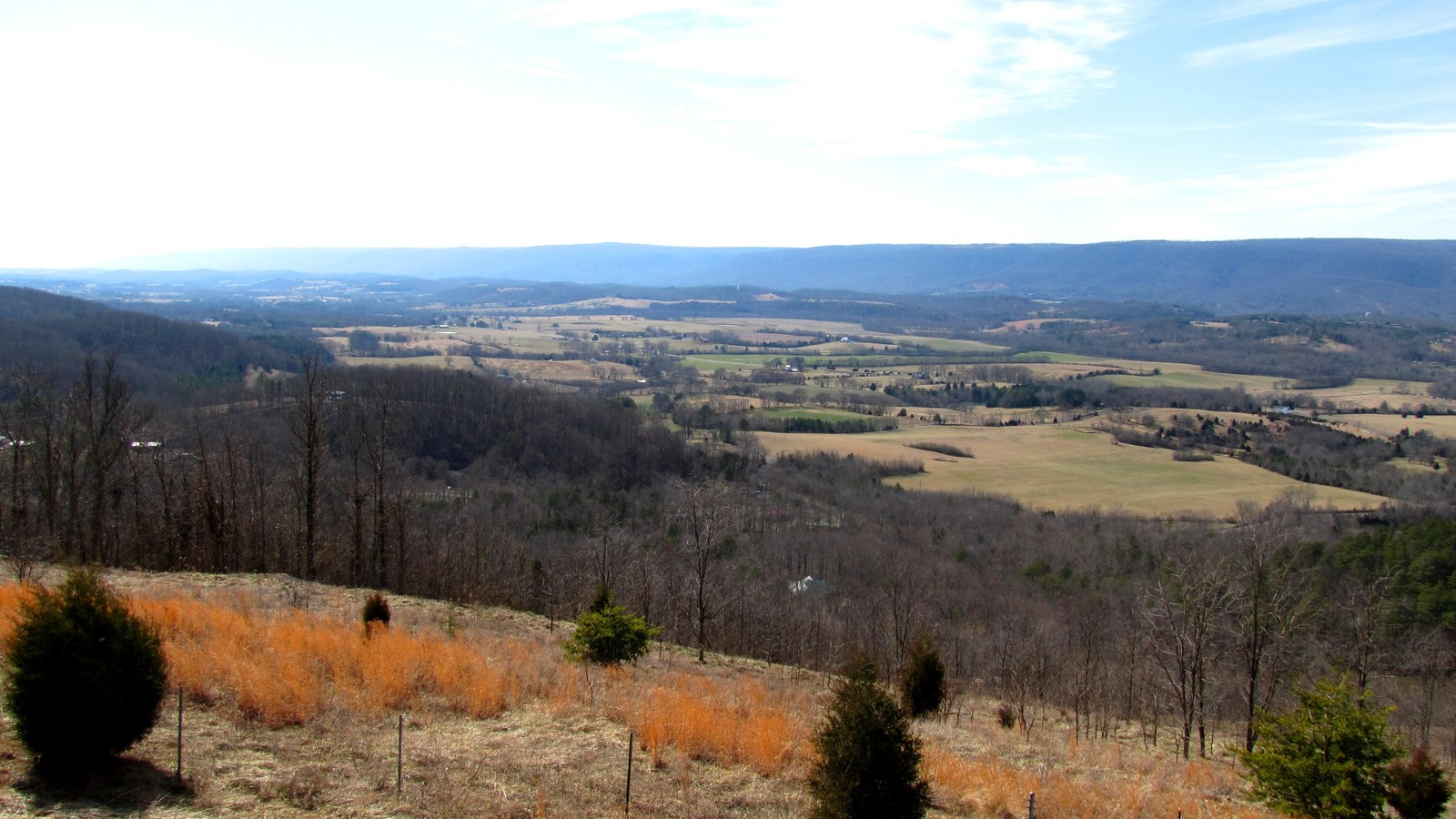
Three nations
In the generations after the Spanish entradas, per Raulston and Livingood, Creek, Shawnee, and Cherokee peoples all claimed most of the land within the present state of Tennessee. Tribal geography knew no fixed boundaries, and the contest for the richest hunting grounds brought recurring warfare. In the early eighteenth century the Creeks, a loose confederation of tribes, were pushed southward out of the region, leaving only local place names to recall their former presence, and the Shawnee were driven from their lands in the Cumberland Valley. With their departure the Cherokee, whose warriors had long hunted and fought in the Sequatchie area, controlled the entire section.
The Cherokee of the early 1700s were the most prominent Native nation in the southeastern country. Kinsmen of the Iroquois, they called themselves Ani-Yunwiya, the “principal people.” The trader James Adair estimated their number in 1735 at sixteen to seventeen thousand, living in some sixty-four villages in the fastnesses of the Unaka Mountains; the portion known as the Overhill Cherokee lived west of the mountains, their towns centered on the Little Tennessee River. After the defeat of the Creeks and Shawnee, the loosely organized Cherokee Nation held the balance of power over a hunting ground of some forty thousand square miles, stretching from the Ohio River south to the shoulders of the Appalachians and west to the Tennessee's northward turn toward the Ohio, a domain other nations continued to enter and dispute. The Sequatchie country sat inside it.
Empires on paper, 1673
Both of the great colonial empires reached toward the Tennessee Valley in the same year. In 1673 the fur trader Louis Joliet and Father Jacques Marquette came down the Mississippi under the banners of Louis XIV, and within a decade La Salle had descended to its mouth and claimed the whole Mississippi Valley for France. La Salle grasped early, in Raulston and Livingood's account, that the Tennessee River was a road leading straight toward the new English settlements on the Atlantic coast, and that in English hands it would drain away French trade. French missionaries, traders, and Quebec's agents planted fortified posts across the interior: a trading station at the “French Lick” near present-day Nashville, Fort Toulouse near the site of Montgomery, and the Gulf cities of Biloxi, Mobile, and New Orleans.
That same year, two Virginians working for the trader Abraham Wood, James Needham and Gabriel Arthur, made the first recorded English exploration into eastern Tennessee. Needham was killed on a return journey, and Arthur survived nearly a year among the river towns, but the door they opened stayed open: a limited Virginia trade with the Cherokee followed, and then a rivalry, because the newly organized colony of Carolina considered Virginia's traders trespassers on ground its own charter carried west to the Mississippi. The story of these first English and French arrivals is told alongside the Spanish expeditions on the Early Explorers page.
The traders' frontier, 1690–1730
Charleston, founded in 1670 as Charles Town, quickly became the hub of the southeastern Indian trade, its merchants building an extensive business in deerskins and furs with the Cherokee. Per Raulston and Livingood, the first of the Carolina traders appeared in the Overhill settlements, east of the Sequatchie Valley, about 1690. Many settled in the Nation, married Cherokee women, and under Cherokee custom were accepted as members of the tribe; their houses stood out in the villages, in a phrase the authors preserve, “like a tower in the city.” Most were Scots, backwoods diplomats as much as merchants, whose pack trains made the three-to-four-week trek from Charleston to the Overhill towns in convoys of a hundred or more animals, and whom the colonial government pressed for intelligence on the French, on guns, and on leaders.
The English regarded the Cherokee country as the “key to Carolina”: the backdoor to the Charleston trade, and strategically vital because the Tennessee River's course through it made French penetration from the Mississippi look easy. Carolina's governments worked to hold a trading monopoly and to stamp out pro-French influence wherever it appeared, and in 1730 a small party of Cherokee was taken to England to visit the King. In London the delegation signed a treaty of everlasting friendship declaring the Cherokee “now children of the King of Great Britain and he their Father.” So, Raulston and Livingood conclude, the Sequatchie country, as part of the Cherokee hunting grounds, came under British protection.
Forts on paper at Long Island
In the Sequatchie country itself, both empires paid special attention to one place: the “Old Creek Crossing,” where the region's merging trails crossed the Tennessee River west of present-day Chattanooga, near the south end of Long Island. Old maps, Raulston and Livingood write, disclose the fluid loyalties and shifting power in this sector. One map, probably drawn about 1715, placed a French fort on an island corresponding to Long Island's location, with the inscription “Since ye Warre a French Fort”; another, published in 1744, marks what appears to be the same site as a “Fort et Poste Anglois.” Whether either fort ever amounted to more than ink, the maps record two empires each claiming the ford that commanded the region's traffic, a spot on the doorstep of what is now Marion County.
Fort Loudoun and the war of 1760
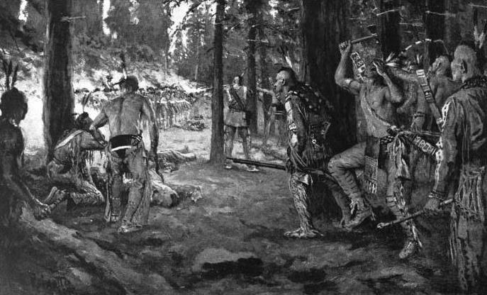
The French and Indian War, opening in 1754, turned paper claims into garrisons. After long delays the English completed Fort Loudoun in 1757 on the Little Tennessee River near the Overhill towns, an isolated symbol of British power built, in fact, at Cherokee request. It did not hold Cherokee loyalty for long. Relations collapsed when the governor of South Carolina seized twenty-eight Cherokee, travelling to Charleston on a peace mission under a pledge of safe conduct, and held them hostage; the hostages were later killed at Fort Prince George. A full-scale war followed. Fort Loudoun was besieged and starved into surrender in early August 1760, the garrison signing terms on August 7 and marching out under a promise of safe passage; on the road, in revenge for the slain hostages, Cherokee warriors attacked the column, killing about three officers, twenty-three privates, and three women and taking the rest prisoner.
The French turn back at the Suck
The Cherokee at once sent runners to New Orleans with news of the British defeat and an invitation to the French to take possession of the country. The French governor ordered a supply mission upriver to Fort Loudoun by riverboat, and the party worked its way up the Mississippi, the Ohio, and the Tennessee as far as the Narrows of the river gorge, where it met the Suck. The period account Raulston and Livingood quote records what happened next:
The waters rolled down with prodigious rapidity, dashed against opposite rocks, and from thence rushed off in impetuous violence on a quarter angle course. It appeared so shocking to the monsieurs that after staying there a considerable length of time in the vain expectation of seeing some of their friends, necessity compelled them to return to New Orleans, to their inconsolable disappointment.
Here, on the eastern edge of the Sequatchie country, the French bid for the valley foundered against the same whirlpool that terrified flatboat crews for the next century and a half. Only a “French Trading Post” marked on old maps, the authors note, testified afterward to the empire's last chance at the territory it had pursued for almost a hundred years.
1763: the map redrawn
By then the French and Indian War had turned decisively against France. The peace treaty of 1763 redrew the map of North America: France ceded the eastern half of the Mississippi Valley, from the great river to the Appalachians, along with Canada, and Spain gave Britain title to Florida. The treaty, in Raulston and Livingood's words, released the Sequatchie area and the whole vast region between the mountains and the Mississippi from the long wars of empire, and it determined not only what flag would fly over the country but the nationality of the settlers who would eventually move into it. A stranger echo of the same war survives in local lore: the legend of Acadian exiles, deported from Nova Scotia in 1755, who camped near Nickajack Cave on their overland search for Louisiana, told on the Nickajack page.
Long Hunters and squatters
With the French claim gone, the practical question became whether Britain could keep its own subjects off the protected Cherokee hunting grounds. It could not. At mid-century Dr. Thomas Walker had explored the country beyond the mountains for Virginia interests, fixing the Duke of Cumberland's name on the Cumberland Mountains, Cumberland Gap, and Cumberland River in place of the older Native names. After the war came the Long Hunters, so called because they stayed in the back country for months or years at a time, masters of the forest who took food, clothing, shelter, and medicine from the woods, ranging without maps or compass in parties of two or three from central station camps. By the mid-1760s they had hunted over most of future Middle Tennessee and much of Kentucky. The nations whose grounds they stripped resented it; one hunter who felt that wrath carved on a tree, “2300 Deer Skins lost Ruination by God.”
Few Long Hunters left any written trace beyond their names on creeks, licks, and ridges. Daniel Boone became the most famous of them. Others, per Raulston and Livingood, included Kasper Mansker, Obediah Terrell, Uriah Stone, Henry Scaggs, Thomas Sharpe Spencer, the brothers Abraham, Anthony, and Isaac Bledsoe, and Elisha Walden, also spelled Wallen, for whom Walden Ridge is a lasting monument: the escarpment that walls the Sequatchie Valley on the east carries a Long Hunter's name to this day. The records reveal no Long Hunters working the Sequatchie area itself, but their reports of Middle Tennessee set in motion the settlement scheme that would send the Donelson flotilla past the valley's front door in 1780.
Settlement followed the hunters' reports quickly. Tradition sets the first permanent white settlement in Tennessee on the Watauga in 1769, with the William Bean family as first residents, and cabins multiplied in upper East Tennessee over the next few years, some planted by settlers who believed the land legally open, others by squatters indifferent to British policy and Cherokee possession rights alike. The British agent John Stuart opposed the occupation, but when the settlers refused to withdraw he recognized that removing them was impossible.
Agents and traders in decline
Britain's postwar policy tried to regulate the Indian trade closely and to hold settlement east of the Appalachians. The Cherokee, weakened by the war, accepted British sovereignty again, and at their request the Crown appointed John Stuart, a former Fort Loudoun officer whose life a friendly chief had spared at the surrender, as His Majesty's Indian Agent for the Southern District. One of Stuart's deputies became a fixture of this region's later history: John McDonald, a Scot from Stuart's own Inverness who arrived in Charleston in 1766 at nineteen, married Anna Shorey, daughter of the interpreter William Shorey and a Cherokee woman, and set up a trading post on South Chickamauga Creek where the Great War and Trading Path crossed the stream. His post would give the Chickamauga their name and their first refuge a decade later. The trade itself, meanwhile, decayed: newcomers of the sort one of Stuart's men called “such a set of villains and horse thieves” worked the towns for profit, and the Cherokee, indebted, were pressured repeatedly to cede land to settle claims against themselves.
Sycamore Shoals, March 1775
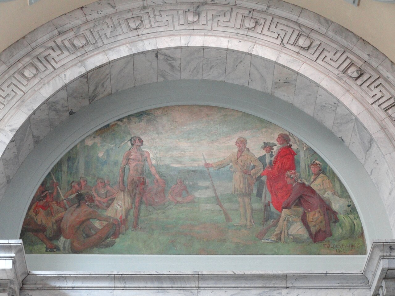
The contest came to its head not at a fort but at a treaty ground. In March 1775, at the Sycamore Shoals of the Watauga River, about 1,200 Cherokee met settlers and the delegates of the newly organized Transylvania Company, assembled at the request of Richard Henderson, a young North Carolina attorney and land speculator the Cherokee called Carolina Dick. Henderson, who had sponsored some of Daniel Boone's explorations and brought Boone with him, arrived with six wagons of trade goods, estimated at 10,000 pounds sterling, and meant to buy an empire: some twenty million acres between the Ohio River and the watershed dividing the Tennessee and Cumberland valleys. That other tribes also claimed parts of the territory, that Virginia's and North Carolina's charters covered it, and that British policy barred white entry did not deter him; nor were Agent Stuart and his deputies told what the gathering was for.
After the first day's courtesies and barbecue, the older chiefs proved agreeable to Henderson's proposal. Then a tall, muscular warrior whose face carried the scars of smallpox rose to protest: Tsu-gun-sini, Dragging Canoe, chief of the town at the Great Island of the Little Tennessee. A sale, he warned, would only lead to more demands, until, in the words Raulston and Livingood record, “finally the whole country, which the Cherokee and their fathers had so long occupied, will be demanded, and the remnant of Ani-Yunwiya, 'The Real People,' once so great and formidable, will be compelled to seek refuge in some distant wilderness.” He did not dissuade the older chiefs. When the signing came, Dragging Canoe stamped the ground, pointed toward Kentucky, and told Henderson for all to hear: “You have bought a fair land, but there is a cloud hanging over it. You will find its settlement dark and bloody.” He left the council and never returned, and many young warriors, seeing the great pile of goods reduced to small rewards for each individual, went with him.
The name he carried had followed him since boyhood, when, forbidden to join a war party against the Shawnee, he hid in a canoe at a portage and, discovered, was told he could come along if he carried it; too small to lift the canoe, he dragged it across. The warning he gave at Sycamore Shoals proved exact. Within two years he had led his followers out of the Cherokee Nation entirely, and the eighteen-year war that followed, fought in large part from towns inside what is now Marion County, is the story of the Chickamauga Wars.
Related
The Early Explorers: Spain, England, and France reach the valley →
The Native American trails and the Old Creek Crossing →
The Cherokee Lower Towns →
The Chickamauga Wars →
The Donelson Voyage, 1779–1780 →
“The Suck” rapids →
The first settlers →
Sources
- J. Leonard Raulston and James Weston Livingood, Sequatchie: A Story of the Southern Cumberlands (Knoxville: University of Tennessee Press, 1974), chapter 3, “Whose Land?,” pp. 25–34.
- Wikipedia — Abraham Wood (the 1673 Needham and Arthur expedition).
- Wikipedia — Fort Loudoun (Tennessee) (construction 1756–1757, the 1760 siege and surrender, the killing of the hostages at Fort Prince George, and the attack on the garrison column).
- Wikipedia — Treaty of Paris (1763) (the French cession east of the Mississippi and the Spanish cession of Florida).
- Wikipedia — Longhunter (the long hunts of the 1760s, the named hunters, and Walden Ridge's naming for Elisha Wallen).
- Wikipedia — Treaty of Sycamore Shoals (the 1,200 Cherokee, the £10,000 in goods, the twenty million acres, and Dragging Canoe's opposition).
- Wikipedia — Dragging Canoe (the name-origin story).
- Chattanoogan.com — Jerry Summers: The Suck (the rapids the French mission could not pass).