Last updated: June 3, 2026
- Location: Tennessee River, at the Hamilton/Marion County line, approximately 8 to 10 miles below Chattanooga
- Cherokee name: Un'tiguhi (“Pot-in-the-water”)
- Other names: The Whirl, The Kettle
- Related rapids: The Boiling Pot, The Skillet, The Frying Pan, Dead Man's Eddy, Tumbling Shoals
- Status: Submerged beneath the Hales Bar reservoir (1913) and now under Nickajack Lake (1967)
For centuries, “The Suck” was the most notorious stretch of water on the Tennessee River. Located where Suck Creek descends from Walden Ridge and enters the Tennessee at the gorge narrows, the rapids compressed the river to less than half its usual width and sent it plunging over immense submerged boulders. The passage wrecked flatboats, defeated steamboats, and shaped the commerce of an entire watershed. Cherokee canoe men knew to wait for calmer water. Early American settlers ran the gauntlet under fire. Engineers spent a decade and millions of dollars to drown it.
The Rapids
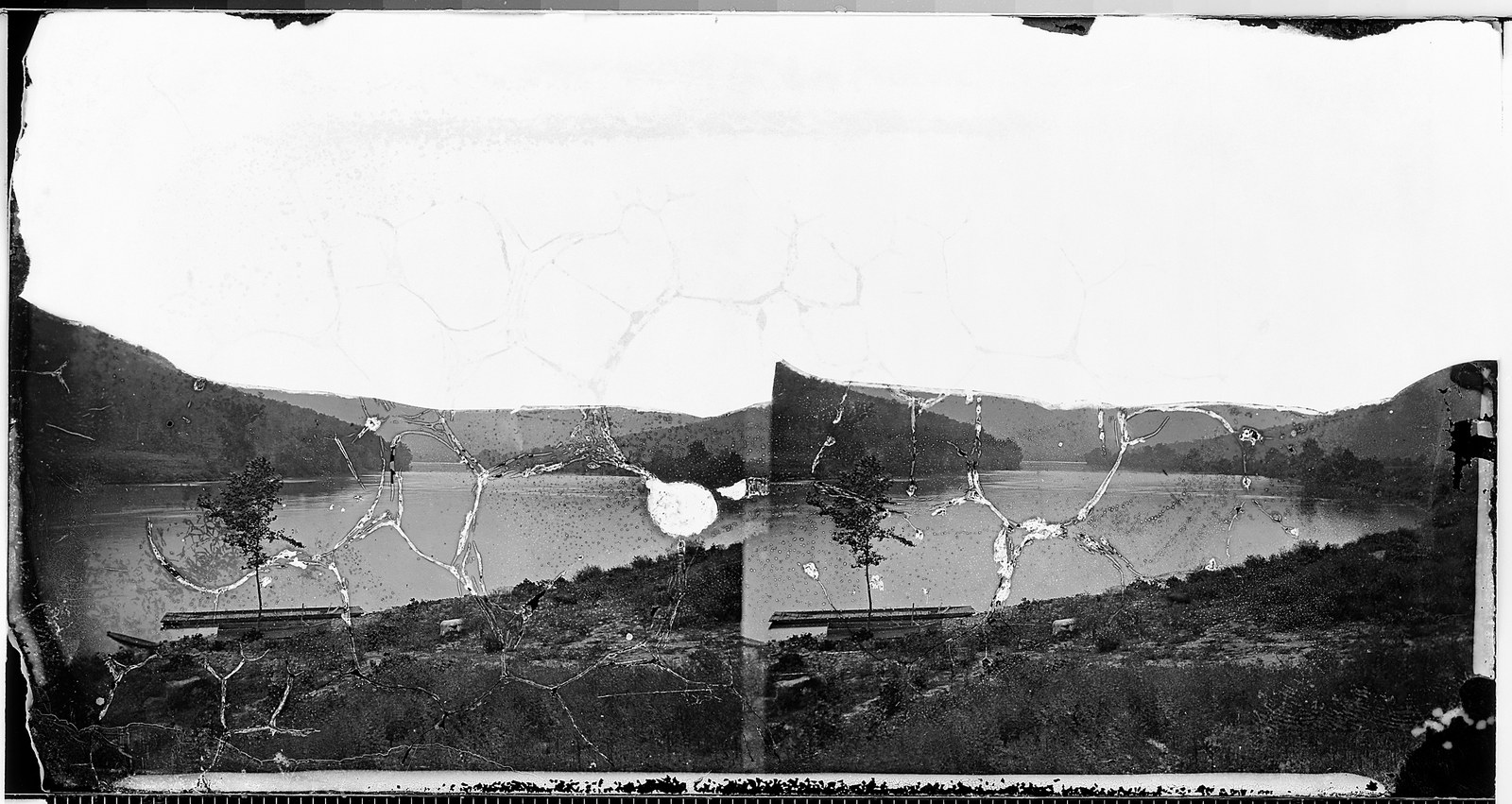
The Suck occupied the point where Suck Creek enters the Tennessee from the east, at the base of Walden Ridge. According to early 19th-century engineer Jacob Dumeste, the current narrowed and descended four and a half feet in 150 yards — a steep fall for a river so large. Immense boulders littered the riverbed, and the confluence of the tributary created a powerful vortex that could spin a flatboat in circles.
At high water, a feature called The Boiling Pot (also simply “The Pot”) formed where the banks narrowed to only 175 feet apart. The churning water gave the impression of a pot at a rolling boil. Below the Pot lay additional hazards, each with a name earned by hard experience:
- The Suck (also called The Whirl or The Kettle): the primary vortex at Suck Creek's confluence
- The Boiling Pot (The Pot): the narrowest point, banks only 175 feet apart
- The Skillet: rapids immediately downstream of the Pot
- The Frying Pan: a wider but still turbulent stretch below the Skillet
- Dead Man's Eddy: a recirculating pool that trapped debris and, reportedly, bodies
- Tumbling Shoals: shallow rocky rapids at the lower end of the sequence
Together, these features made the gorge passage one of the most dangerous stretches of navigable water in the eastern United States.
Cherokee Knowledge
The Cherokee knew the rapids as Un'tiguhi, meaning “Pot-in-the-water.” Cherokee tradition held that the whirlpools were intermittent. Experienced canoe men would stop upstream and wait, watching the water until the vortex subsided enough to allow passage.
Cherokee oral tradition preserved a vivid legend about the site, recorded by James Mooney in his Myths of the Cherokee. Two men going down the river in a canoe were drawn into the whirlpool; one was seized by a great fish and never seen again, while the other was carried round and round to the very center of the maelstrom, where the water seemed to open beneath him. Looking down “as through the roof beams of a house,” he saw a great company of people on the river bottom who looked up and beckoned him to join them, but as they reached out to seize him the current caught him and bore him up and out to safety. The rapids were also associated with the mythological figure Untsaiyi, a legendary gambler whose stories Mooney also recorded.
Donelson's Voyage (1780)
The Suck entered the written record through one of the most consequential frontier journeys in Tennessee history. On December 22, 1779, John Donelson departed Fort Patrick Henry aboard the flatboat Adventure, leading a flotilla of roughly 30 boats carrying more than 200 Anglo-American settlers bound for the Cumberland settlements at present-day Nashville.
The fleet reached the gorge around March 1780. Donelson's journal describes the passage: “the Whirl, or Suck, where the river is compressed into less than half its usual width” and “the upper part of these narrows at a place termed the Boiling Pot.” The Adventure became lodged in the whirlpool, a stationary target under fire from Chickamauga Cherokee warriors positioned on the bluffs above.
One person was killed and several were wounded on Donelson's boat before the crew freed the vessel. A separate boat that had fallen behind, its crew weakened by smallpox, was less fortunate. Its occupants were killed or taken prisoner. Donelson and the surviving boats completed their journey, reaching Nashville on April 24, 1780.
Travelers in the written record: Hutchins and Winterbotham
The Suck appears in the written record earlier than Donelson's famous run. Twelve years before, in 1768, the British military engineer Thomas Hutchins surveyed the Tennessee River and set down the name, describing how “here is the suck at which place the River is about 60 yrds. over,” with the channel widening to more than a quarter-mile a few miles upstream and the mountains “gathering Lap over both sides of the River resembling a Brick Fortification.” His is the earliest known written use of the name.
A generation later, in 1795, the British compiler William Winterbotham described the same passage as “a greater curiosity than the bursting of the Potomack through the Blue ridge.” The river, he wrote, “which a few miles above is half a mile wide, is here compressed to the width of about one hundred yards”; a rock projecting from the northern bank threw the water against the southern shore and “produces the whirl, which is about 80 yards in circumference,” into which “canoes have often been carried into this whirl and escaped by the dexterity of the rowers without damage.” Both descriptions are preserved in Raulston and Livingood's Sequatchie (1974), drawing on Samuel Cole Williams's Early Travels in the Tennessee Country.
The Navigation Problem
The rapids turned the Tennessee River into what was effectively a one-way highway. Flatboats and keelboats could run downstream through the gorge with difficulty, but upstream passage was nearly impossible without assistance. Even after steamboats arrived on the river, they could not pass through the Suck fully loaded going upstream. Cargo had to be offloaded, portaged around the worst stretches, and reloaded on the other side.
This bottleneck capped commercial development across the entire upper Tennessee watershed. Towns above the gorge could not efficiently ship goods to Chattanooga or points south and west, and supplies moving upstream were expensive and slow. The rapids were not merely a local hazard. They constrained the economy of a region.
Hales Bar Dam (1913)
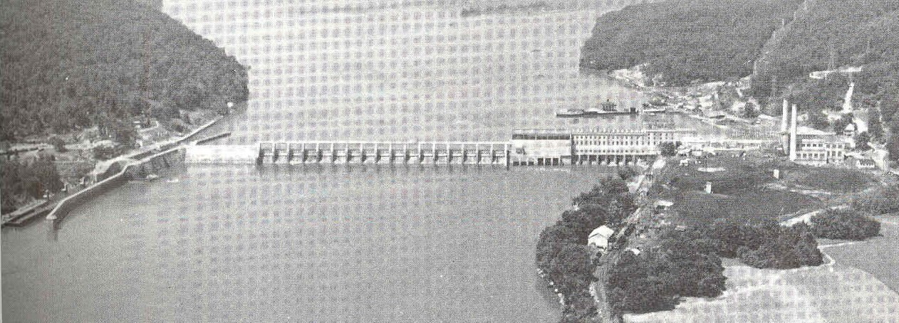
The solution came in the form of a dam. On October 17, 1905, the Chattanooga and Tennessee River Power Company broke ground on Hales Bar Dam, located just downstream of the rapids at Hales Bar. The project was organized by Josephus Conn Guild, Charles E. James, and Anthony N. Brady, with construction carried out by the William J. Oliver and Company contracting firm.
The original cost estimate of $3 million ballooned to roughly $10 million as engineers struggled with soft, porous limestone bedrock that allowed water to pass beneath and around the dam structure. Construction took eight years. The dam was completed on November 11, 1913, and began generating power on November 13.
As the reservoir filled in October 1913, the rapids disappeared. The Suck, the Pot, the Skillet, and Dead Man's Eddy all drowned beneath the rising water. One account captured the moment: “On or about October 22, 1913, people who lived near the Suck went to bed one night with the familiar sound of rushing water in their ears. When they woke, the river was still.”
Hales Bar Dam leaked almost from the day it opened, a consequence of the same porous bedrock that had driven up construction costs. TVA acquired the dam in 1939 and spent decades attempting repairs before ultimately deciding to replace it.
The Gorge Today
Nickajack Dam, completed by TVA on December 14, 1967, replaced Hales Bar Dam. Nickajack Lake now covers the old rapids site. The Suck lies beneath the lake surface, and the whirlpool that terrified generations of boatmen is gone. Suck Creek still flows into the Tennessee at the same confluence, but it enters slack water instead of a vortex.
The gorge walls survive largely unchanged. Much of the surrounding land is managed by the Tennessee River Gorge Trust, a land trust that protects more than 16,000 acres along the gorge. The name persists in local usage, among paddlers, and in the name of Suck Creek itself.
Sucktown: the nickname that rode the dam
During the 1905 to 1913 construction of Hales Bar Dam, the rough industrial settlement that grew up around the worker camps picked up the informal nickname Sucktown, borrowed upstream from the rapids the dam was drowning. The nickname survived in period newspaper coverage and in later oral history of the Guild and Haletown communities even after the rapids themselves disappeared. It is one of the clearer examples of how the Suck's cultural footprint outlasted its physical existence; the word persisted long after the whirlpool was gone.
Related
- Hales Bar Dam →
- Tennessee River Gorge →
- Nickajack →
- Cherokee Lower Towns →
- Haletown & Guild →
- Folklore and Local Lore →
Sources
- Wikipedia: Hales Bar Dam
- Wikipedia: Nickajack Dam
- Tennessee Encyclopedia: Marion County
- Claiborne Progress: “Hales Bar Dam Obliterated the Suck 110 Years Ago” (2023)
- Mooney, James. Myths of the Cherokee: “The Removed Townhouses”
- Clarksville Online: “History of Renfroe Station on Red River, 1780” (Donelson's voyage)
- J. Leonard Raulston and James Weston Livingood, Sequatchie: A Story of the Southern Cumberlands (Knoxville: University of Tennessee Press, 1974), chapter 2, “Visitors and the Land,” pp. 21–22 (Hutchins's 1768 survey, Winterbotham's 1795 description, and the Cherokee whirlpool myth).