Last updated: May 4, 2026
- Type: Unincorporated community
- Location: On the Cumberland Plateau directly above Whitwell, in central Marion County, along Mount Olive Road
- Elevation: Approximately 2,073 feet (632 m)
- ZIP code: 37397 (Whitwell)
Setting
Mount Olive is a ridgetop community on the Cumberland Plateau directly above Whitwell. From the Sequatchie Valley floor around the Whitwell business district, Mount Olive Road climbs the escarpment and then fans out across the plateau top. The community sits at just over 2,000 feet in elevation, roughly 1,300 feet above the valley town below. The plateau here is wooded, dotted with small homes, churches, farms, and the scars of old surface-mining operations.
Mount Olive is not separately incorporated and shares a ZIP code with Whitwell. Most of what is commonly called Mount Olive falls along Mount Olive Road itself, with branching county roads serving additional ridgetop settlements; the broader mountain above Whitwell is sometimes called simply Whitwell Mountain in local usage.
The community's name follows a common Southern naming pattern in which the settlement takes the name of its earliest or most prominent church. A congregation called Mount Olive, the name a reference to the Mount of Olives of biblical tradition, gave its name first to the road, then to the ridgetop community around it. Mount Olive Cemetery, the community burial ground still in use, predates the current churches and preserves the oldest surviving tie between the 19th-century congregation and the modern settlement.
The plateau top here fell within the Cherokee homeland before the 19th-century coal era. Archaic and Woodland period rockshelter and camp sites are documented along the Cumberland escarpment above Whitwell, and by the 18th century the ridge and the cove below were part of the country held and travelled by the Chickamauga (Lower) Cherokee. The Cherokee who remained in the valley were forcibly removed along the Trail of Tears in 1838, seven years before the commercial coal seams on this ridge were opened. The Cherokee Nation continues today as a sovereign nation headquartered in Oklahoma.
The coal corridor above Whitwell
The mountain above Whitwell was the business end of Marion County's largest 19th- and 20th-century coal operations. The British-owned Sewanee Coal, Coke and Land Company, formed when Whitwell's mines were sold to English investors in the 1880s, ran drift mines into the plateau seam on the ridge above town. Coke ovens were built further down the mountain and in the valley itself. The mining families who worked those drifts lived partly in Whitwell, partly in smaller company housing up on the mountain. Mount Olive grew as one of those ridge communities, inheriting buildings, cemeteries, and road patterns from the coal era.
The commercial coal mining above Whitwell continued, through several successor companies, until the mines closed in the mid-1990s. The scars of the old workings, benched ridges, coal-tinted spoil, and subsidence features, can still be read on the landscape around Mount Olive and on the faces of the escarpment below it.
Churches and cemeteries
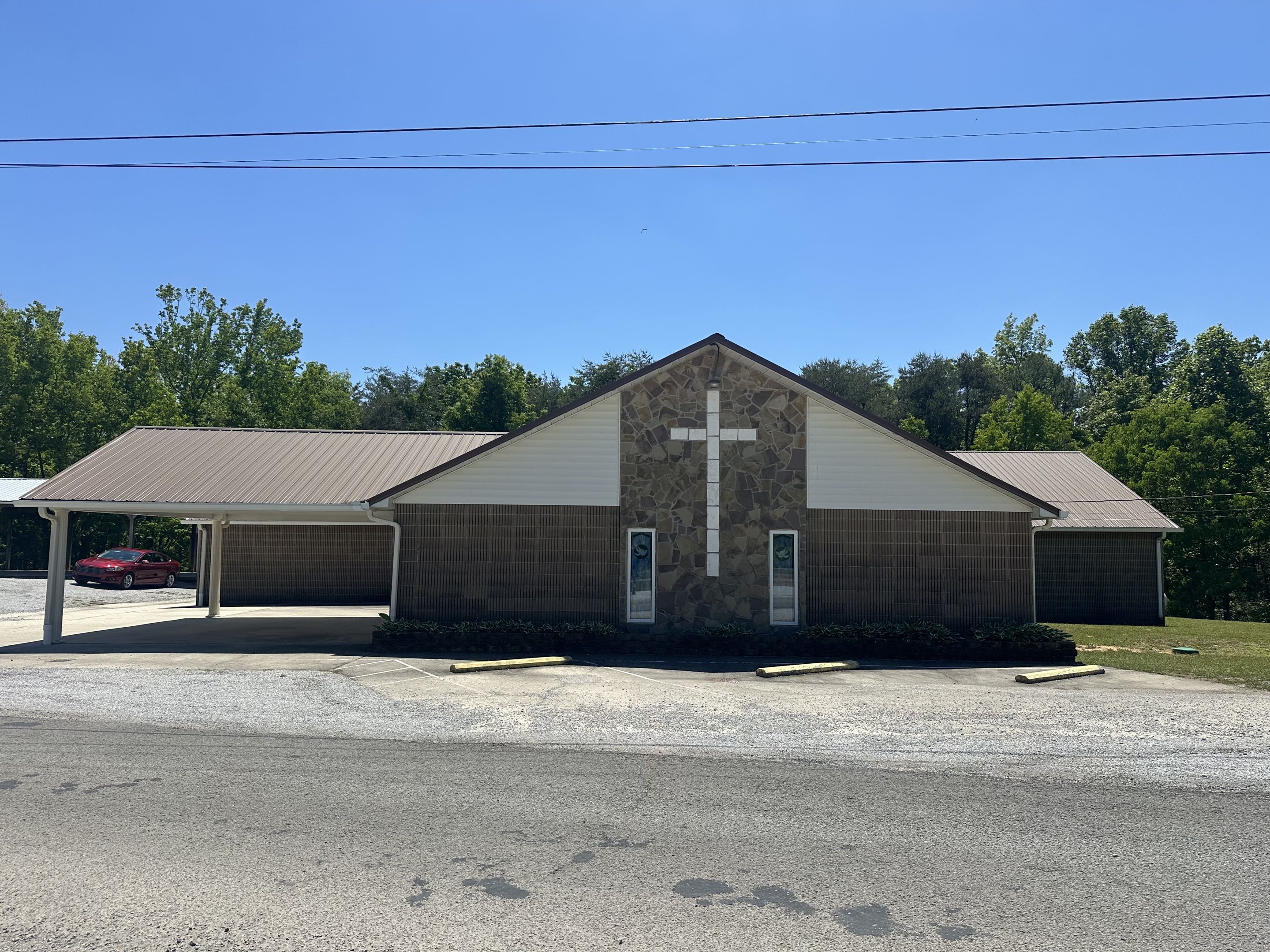
Cumberland Mountain Church of God, at 4902 Mount Olive Road, was founded in 1935 and is one of the older congregations still meeting on the ridgetop. It is affiliated with the Church of God (Cleveland, Tennessee), a Pentecostal denomination that traces its roots to an 1886 meeting at Barney Creek in the mountains of eastern Tennessee and spread heavily across the Cumberland Plateau in the early twentieth century. The church offers Bible study, youth programs, and prayer groups and remains an active congregation serving the plateau-top community.
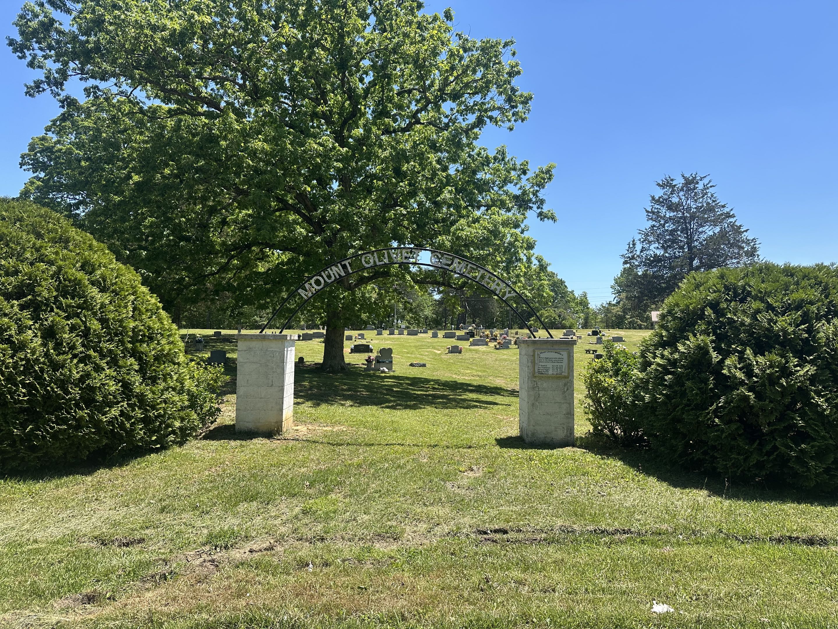
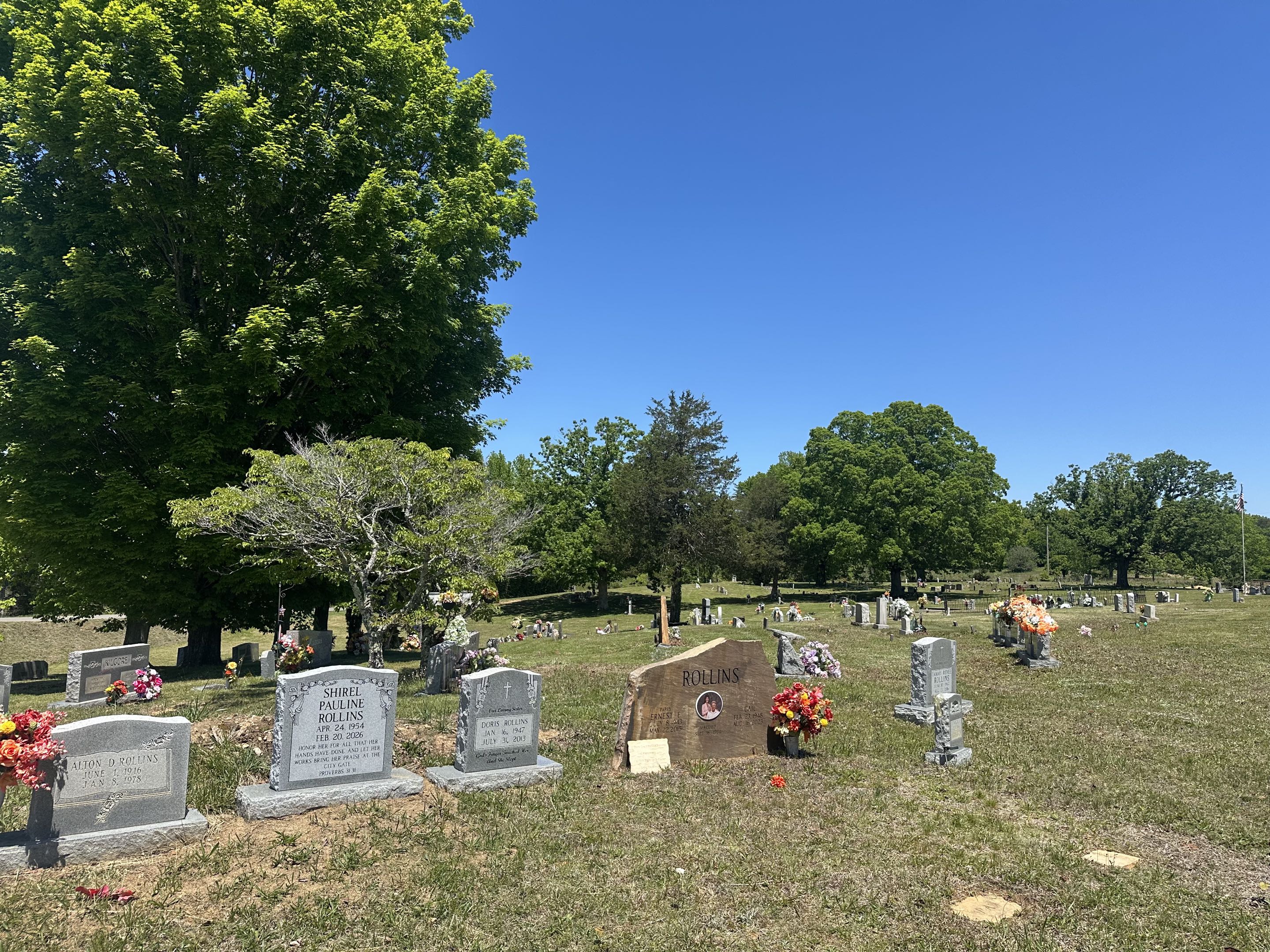
Mount Olive Cemetery (sometimes rendered "Mount Olivet" on signage; GNIS Feature ID 1317586) is the community burial ground at 4744 Mount Olive Road, mapped on the Whitwell USGS 7.5-minute quadrangle at approximately 35.199° N, 85.549° W. Find a Grave records 340 memorials, with burials dating from the 1890s to the present. The dominant family surnames are Kilgore (at least 20 memorials), Basham (at least 20), Morrison, Stephenson, Atterton, Green, Slatton, Nunley, Rutherford, and Rollins, all coal-era families whose presence on the ridgetop traces to the Sewanee Coal, Coke and Land Company operations. The oldest individuals buried here were born in the 1830s and 1840s, predating the Civil War. The cemetery predates the current churches and preserves the oldest surviving institutional tie between the original 19th-century Mount Olive congregation and the modern settlement.
The USGS maps document Walker Cemetery, Layne Cemetery, Gordon Cemetery, and three separate Pryor Cemeteries on the Whitwell quad, all within a few miles of Mount Olive. These families maintained their own burial grounds but are connected to Mount Olive through intermarriage: Layne and Walker appear as maiden names in the Mount Olive roster (Katherine Lenore Layne Basham, Delma Juanita Walker Nunley, Elizabeth "Lizzie" Layne Towell), tracing the kinship ties that linked plateau families across their separate burial grounds. The Walker, Layne, Pryor, and Gordon families were among the households who lived and worked in the drift mines and coke operations of the Sewanee Coal, Coke and Land Company and its successor operations from the 1880s through the mid-20th century. Together, these family cemeteries and the community cemetery at Mount Olive map the footprint of the coal settlement on Whitwell Mountain.
Mount Olive School
A one-room or small community school called Mount Olive School served plateau-top families before consolidation. It is listed among the more than one hundred small schools in the Marion County historical schools roster and was absorbed into the Whitwell district as school buses took over the descent into town. The site of the old school is no longer in educational use.
Present day
Mount Olive today is a quiet rural community. Its population is not separately tabulated by the census, but Mount Olive Road and its branches include homes, churches, cemeteries, and stretches of forest on former mining property. The community has no commercial center of its own; residents typically drive down the mountain to Whitwell for groceries, the post office, and school, or further on to Jasper and South Pittsburg for larger errands.
In November 2023 a wildfire spread rapidly across Whitwell Mountain in the vicinity of Mount Olive Road, a reminder that the combination of steep terrain, dry autumn forest, and the long legacy of surface disturbance on the plateau still poses a risk to plateau-top homes.
Related
Whitwell →
Mount Olive Cemetery →
Coal and coke →
Sequatchie Valley →
Historical schools of Marion County →
Sources
- Wikipedia — Whitwell, Tennessee
- Sequatchie Valley National Scenic Byway — Whitwell
- Southeast Tennessee Tourism — Coal Miners Museum in Whitwell
- Local 3 News — Wildfire on Whitwell Mountain, November 2023
- RootsWeb TNGenWeb — Marion County Cemeteries on USGS Maps (Mount Olive Cemetery, GNIS 1317586)
- HometownLocator — Mount Olive Cemetery (GNIS Feature ID 1317586)
- Find a Grave — Mount Olivet Cemetery, Whitwell, Marion County, TN (340 memorials)
- Church Angel — Cumberland Mountain Church of God (founded 1935)
- Tennessee Encyclopedia — Church of God