Last updated: April 22, 2026
- Type: Unincorporated cove / rural residential area
- Location: Northwestern Marion County at the Battle Creek headwaters, on the south slope of Monteagle Mountain below the plateau rim; accessed from Ladds Cove Road off U.S. 41 and TN-156
- Mailing ZIP: 37380 (South Pittsburg rural carrier route), with some Monteagle (37356) addresses near the plateau rim
- Named for: Ladd-family landowners; “Ladd” appears in the TNGenWeb map of first-settler surnames for Marion County
- Not to be confused with: Ladd, the early-1900s Hales Bar Dam worker village on the Tennessee River near Haletown, about twenty miles away
Setting
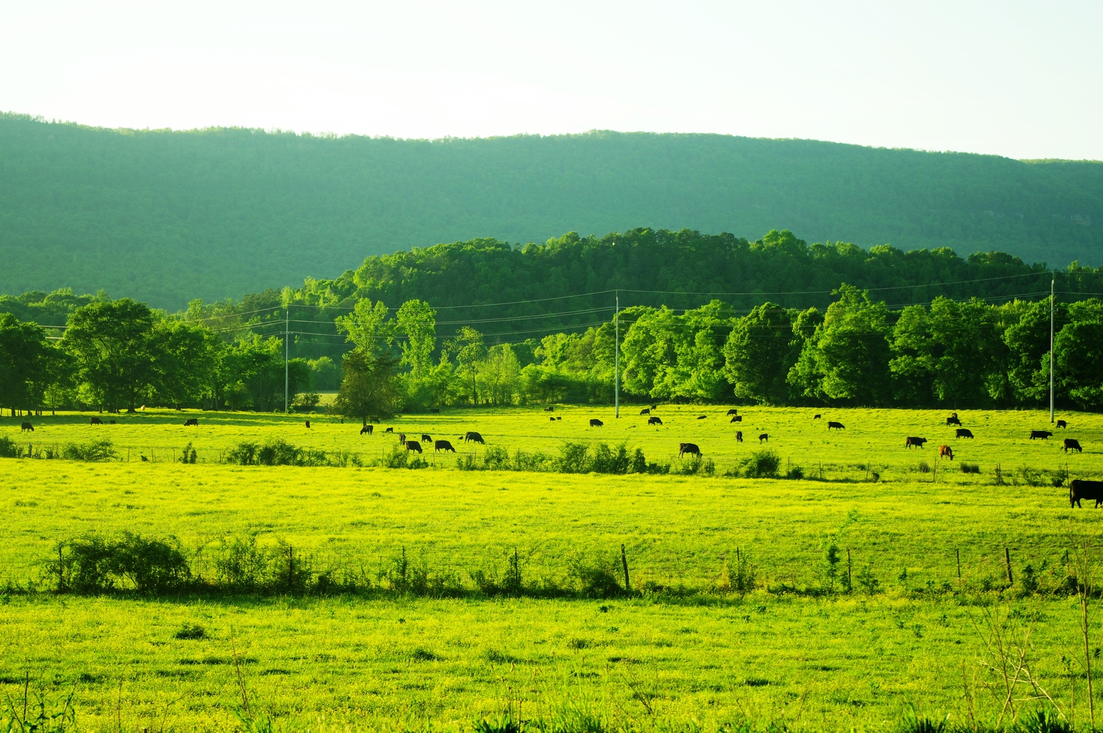
Ladds Cove is a small valley at the head of the Battle Creek drainage, tucked into the south face of Monteagle Mountain. The rim of the Cumberland Plateau rises to the north along the line of the town of Monteagle; Battle Creek itself springs from the base of that escarpment and runs southwest through the cove before turning west toward the Tennessee River. The cove is drained by Battle Creek, Cave Cove Branch, and a handful of smaller tributaries, all of which join below the cove and pass through the upper end of Sweetens Cove before reaching the main Battle Creek stem.
The cove is reached from Ladds Cove Road, which drops south off Monteagle and descends through the bluff line onto the valley floor. It is distinct from the town of Monteagle, which sits on the plateau rim above, and from Ladd, the early-20th-century Hales Bar Dam worker village on the Tennessee River near Haletown. The two places share a family name but are otherwise unrelated: Ladd is a river-bank community at about 700 feet of elevation near TN-156, and Ladds Cove is a plateau-base cove at higher elevation, more than fifteen miles away as the crow flies.
Cherokee and pre-Cherokee presence
Ladds Cove lies in the headwater country of Battle Creek, which had been Indigenous territory for thousands of years before the Ladd family arrived. Archaeological work along the Battle Creek drainage and the caves that open along the plateau rim above the cove documents Archaic and Woodland use (roughly 8000 BC to AD 900); Monteagle Saltpeter Cave, historically called Battle Creek Cave and only a short distance away, was mined for saltpeter by Indigenous peoples long before Confederate and earlier Euro-American operators worked its hoppers in the 19th century.
By the late 18th century, the cove lay in the upland margin of the Cherokee homeland, on the seam between the Chickamauga (Lower) Cherokee towns downriver at Nickajack and Running Water and the pattern of scattered hunting camps and small settlements that used the plateau coves. Battle Creek itself carries a name tied to clashes between Cherokee fighters and Anglo-American intruders in the years before 1800, and Marion County historical sources place a Cherokee town called Crowmocker in the wider Battle Creek cove. Under the Treaty of 1819, at least six members of the Lowrey family took 640-acre reservations along the main stem of Battle Creek below this cove; most were pressed off their land by the mid-1820s, and the remaining Cherokee community in the county was forcibly removed along the Trail of Tears in 1838. The Cherokee Nation, today a sovereign nation headquartered in Oklahoma, traces a portion of its ancestry through the families of the Lower Towns.
Name origin and Anglo-American settlement
Both the cove and the road carry the Ladd surname. “Ladd” appears on the TNGenWeb Marion County first-settlers map alongside Griffith, Condra, Raulston, Bean, Rankin, Doran, Tate, Bible, Pryor, Thach, Patton, and McDaniel, Anglo-American families who arrived between the 1790s and 1830s as Euro-American settlement filtered into the county after the dismantling of the Cherokee Lower Towns. The earliest documented Ladd landowner in the county is Amos Ladd, who appears on the 1824 Marion County landowner roll, among the first tax-paying property owners recorded after the county's 1817 organization; the Ladd family continues in later 19th-century Marion County records. Ladd-family landowners settled in the cove over the course of the 19th century, and the name followed the land; by the early 20th century, “Ladds Cove” appeared consistently in deeds, maps, and local usage for the valley itself and for the road down into it.
The two Marion County “Ladd” names trace to different branches of landowners, not to a single estate. Ladds Cove is the older of the two as a place-name, because Ladd on the river was built up in the first decade of the 20th century as a Hales Bar Dam company village, while Ladds Cove had already been a farming-and- woodland cove for several generations by that point.
A small Episcopal presence
Local usage and community recollection refer to a Ladd's Cove Episcopal Church active in the cove; references to it appear in obituaries and community remembrances associated with the Battle Creek-and-Monteagle area. A primary institutional source for the church, a diocesan listing, a marker, or a dated founding record, has not been located, so the church is included here as a local-account mention rather than as a documented parish history.
Present day
Ladds Cove is a rural residential area of scattered homes, woodland lots, farms, and small pastures along Ladds Cove Road and its side branches. The cove has no incorporated government, no post office of its own, no school, and no commercial center; it is better described as a named valley and a dispersed settlement than as a town. Mail goes out under the South Pittsburg rural carrier route (ZIP 37380) for most of the cove, with some Monteagle (37356) addresses along the upper end near the plateau rim. Civic services are provided by Marion County from Jasper and by the Marion County school system.
Related
Ladd (not this place) →
Monteagle →
Battle Creek →
Sweetens Cove →
First settlers of Marion County →
Sources
- Wikipedia — Monteagle, Tennessee (drainage reference: “the south side of Monteagle drains into Ladd Cove and Cave Cove”)
- TNGenWeb Marion — First Settlers of Marion County
- Marion County TNGenWeb
- RootsWeb Marion County TNGenWeb — cities and communities list