Last updated: April 19, 2026
- Waterfall height: ~60 feet
- Stream: Little Gizzard Creek
- Small Wild Area: ~178 acres
- Denny Cove: 685 acres, acquired 2016
- Park: South Cumberland State Park (~30,000 acres total)
- Access: Cumberland Plateau escarpment near the Grundy/Marion county line
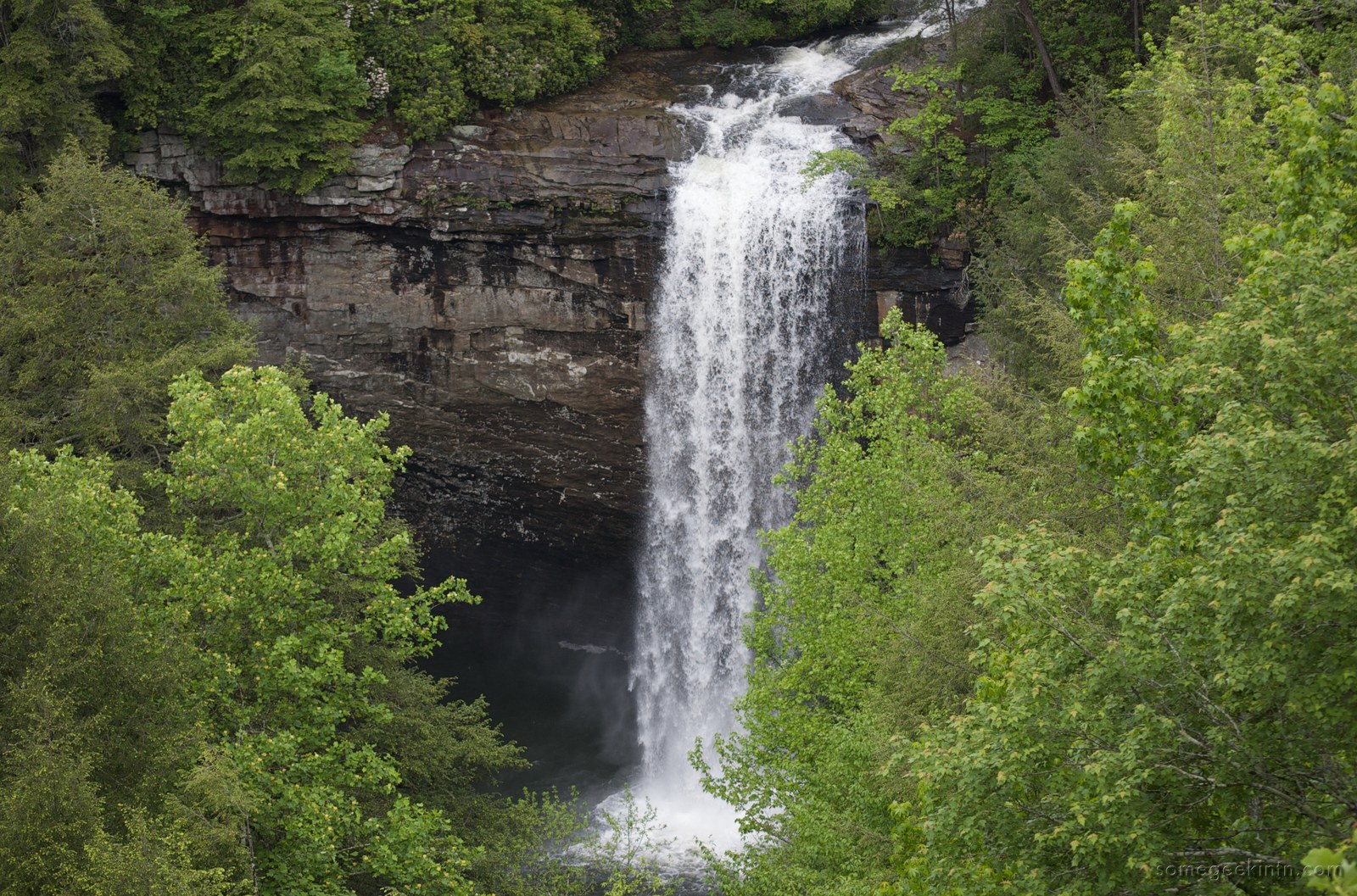
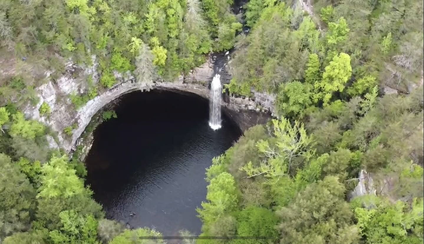
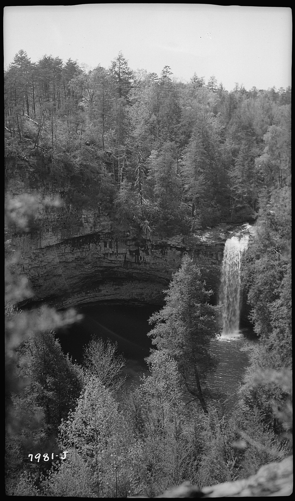
Foster Falls is a waterfall on Little Gizzard Creek where the stream drops approximately 60 feet over the sandstone rim of the Cumberland Plateau into a plunge pool below. It is the tallest waterfall in South Cumberland State Park, which encompasses nearly 30,000 acres across nine separate tracts on the southern Cumberland Plateau. The falls and surrounding Small Wild Area are among the more heavily used recreation areas on the plateau, drawing hikers, swimmers, and rock climbers.
Geology
The falls drop over a ledge of Pennsylvanian-age sandstone, the same resistant caprock that forms the rim of the Cumberland Plateau throughout the region. Below the sandstone rim, softer Mississippian-age limestones and shales erode more quickly, creating the vertical cliff face and the amphitheater-like gorge at the base. The tougher sandstone cap is less porous than the limestone beneath it, creating conditions for high-elevation seep bogs on the plateau surface where water pools above the impermeable rock.
Ecology
The gorge below the falls supports a cool, moist microclimate distinct from the plateau surface above. Hemlock, mountain laurel, and azaleas grow along the sandstone rim, while the gorge harbors cove-hardwood species including birches and a range of ferns, sedges, and mosses. The broader South Cumberland system supports 636 documented vascular plant species, including hemlocks over 200 years old. The sandstone seep bogs on the plateau surface near the falls host specialized plant communities adapted to wet, acidic, nutrient-poor conditions that are uncommon in the surrounding landscape.
Foster Falls Small Wild Area and hiking
The Foster Falls Small Wild Area covers roughly 178 acres around the falls and the head of the gorge. Trails from the parking area reach the overlook above the falls, descend to the plunge pool at the base, and connect to the Fiery Gizzard Trail, which continues north across the plateau toward Tracy City in Grundy County.
The Fiery Gizzard Trail is a 12.5-mile route that runs from Tracy City to Foster Falls, following Fiery Gizzard Creek through boulder fields, swimming holes, and gorges before climbing roughly 500 feet to Raven Point, a sandstone overlook. Backpacker magazine has cited it as one of the top 25 hiking trails in the United States. The trail is among the most rugged in Tennessee and connects the Foster Falls area to the broader South Cumberland trail network.
Climbing
Foster Falls is a well-known sport-climbing destination, with routes on the sandstone cliff bands ringing the gorge. The climbing is managed in coordination with the Southeastern Climbers Coalition (SCC), a nonprofit that works to preserve climbing access on public and private lands. The sandstone walls provide a range of difficulty levels and attract climbers from across the Southeast.
Denny Cove
Denny Cove is an adjacent unit of South Cumberland State Park a short distance north of Foster Falls, between Foster Falls and Castle Rock. In July 2016, a partnership led by the Southeastern Climbers Coalition and the Access Fund purchased the 685-acre property from a timber investment company for $150,000, with support from the Land Trust for Tennessee and the Conservation Fund. The State of Tennessee acquired the land from SCC in December 2016, and Denny Cove was dedicated as part of South Cumberland State Park in March 2017.
The cove includes nearly three miles of cliff line with approximately 150 established climbing routes and potential for many more. A 2.7-mile round-trip trail leads to Denny Falls, a 70-foot waterfall, with about 364 feet of elevation change. Primitive campsites are available on the property. The acquisition permanently protected the cove's sandstone walls, forest, and waterfall from timber harvesting and development.
Related
The Marion County hiking & trails hub →
About the Cumberland Trail →
About the Sequatchie Valley →
About Marion County flora →
Back to Geography →
Sources
- Wikipedia: South Cumberland State Park
- Wikipedia: Fiery Gizzard Trail
- South Cumberland State Park, TN State Parks
- Friends of South Cumberland State Parks: Park Overview
- Land Trust for Tennessee: Denny Cove, Marion County
- Access Fund: Denny Cove, Tennessee, 2016
- Southeastern Climbers Coalition: Foster Falls
- Southeastern Climbers Coalition: Denny Cove